Academy of the Assumption (Mass Bay)

Let’s start this post off with a little thought experiment. Pretend for a moment that you’re the CEO of a company that manufactures and sells widgets. For years, everything was hunky-dory. Profits were high and the future always looked strong. But lately, demand for your widgets has decreased significantly and your business is hemorrhaging money. It’s obvious you need to do something.

So as CEO, what should you do to turn your company around? Perhaps reinvent your product? Invest in a new marketing campaign? Restructure your operations to improve efficiency and reduce costs?

Makes sense? It’s called Business 101.

Now, what’s the 100% wrong approach to take? How about sticking with the same old strategy and even spending millions of dollars to construct a second factory that manufactures identical widgets as the ones that aren’t selling? That basically guarantees failure, right?

Well, that’s pretty much what the financially-strapped Archdiocese of Boston did in the mid-1960s when it spent $5.5 million to construct a new high school building for the Academy of the Assumption in Wellesley (now the site of Mass Bay Community College) and a new Formation Center for the Sisters of Charity of Halifax (currently used as the Elizabeth Seton Residence) on the opposite side of the road adjacent to what is now Centennial Park.

I think I’m justified in saying that this was a pretty dumb move. Although the Academy desperately needed a new high school, things were changing within the Catholic Church. Yes, membership was still strong. But it was more or less at that time — the early-to-mid-1960s — that the number of women entering Sisterhood peaked. Furthermore, fewer and fewer of these religious sisters were becoming teachers.

None of those facts were unknown to Church officials. Even the Archbishop of Boston, Richard Cushing, spoke solemnly about the future of the Catholic Church at the dedication ceremony for the new high school.

Let me repeat that: The guy in charge of the entire Archdiocese was openly worried even as he marked the completion of a high school that had been constructed for $2 million (through loans). And then he goes ahead and authorizes the expenditure of $3.5 million (again, using money the Church hadn’t raised yet) to establish a Formation Center that would hopefully increase the number of young women entering the Sisterhood.

Did Cardinal Cushing and other Church officials really think that the only problem was a lack of training and educational services? Was it not obvious to everyone that society was in the midst of radical changes and that the best way to survive was to adapt to them?

OK, perhaps I’m getting ahead of myself. Some of you might have no idea what I’m talking about. Who were these Sisters of Charity of Halifax? And how in the world did they end up in Wellesley?

The short answer: The Sisters of Charity of Halifax were a group of women from a congregation in Halifax, Nova Scotia who were sent on a mission in the late 19th Century to establish a school for young women in the Boston area.

The long answer: Please fasten your seatbelts. We’re going for a ride!

Let’s start this off more than two centuries ago, all the way back in 1803. But not in Wellesley or even Canada. Nope, Italy marks ground zero for this story. After all, it was here that Elizabeth Ann (Bayley) Seton first discovered Catholicism.

I’ll spare you the full biography of Elizabeth Seton, but there’s a certain amount of information that we can’t ignore. Like the fact that she was born into a prominent and deeply Protestant family in New York City. And that, as a wife and mother of five young children living in Manhattan, Elizabeth found herself in an unforeseen situation when her husband, William Seton, contracted a serious case of tuberculosis that was so unresponsive to the most advanced medical treatments of the time that his doctors prescribed a sea voyage to Europe as a last resort to revive his health.

Unfortunately, it only got worse when Elizabeth and William (along with one of their children) stepped off the boat in Livorno, Italy. Rather than resting at a mountainside villa, the family was immediately quarantined in a lazaretto for a month — not for tuberculosis, but because there was a yellow fever epidemic in New York and Italian officials believed that their ship was contaminated. Unable to receive the care he needed, William died only a week after his release.

One would think that his death would send Elizabeth’s life into despair. But this didn’t happen. On the contrary, she showed an absolutely remarkable amount of strength and fortitude even despite having to wait three months to sail home due to rough seas.

There must, however, have been at least some yearning for solace because it was at this precise time that Elizabeth first discovered the Catholic faith. (Remember, America was almost entirely Protestant at the time.)

In fact, she even writes about this moment in a letter to her sister:

“Four days I have been at Florence, lodged in the famous palace of Medici [where she was living with the family of Anthony Filicchi, one of her late husband’s creditors]…On Sunday, January 8, at 11 o’clock, I went with Mrs. Amabilia [the wife of Anthony Filicchi] to the chapel La Santissima Annuziata. Passing through a curtain, my eye was struck with hundreds of persons kneeling; but the gloom of the chapel, which is lighted only by the wax tapers on the altar, and a small window at the top darkened with green silk, made every object at first appear very indistinct, while that kind of soft and distant music which lifts the mind to a foretaste of heavenly pleasures called up in an instant every dear and tender idea of my soul, and, forgetting Mrs. A.’s company and all the surrounding scene, I sank on my knees in the first place I found vacant, and shed a torrent of tears at the recollection of how long I had been a stranger in the house of my God, and the accumulated sorrow that had separated me from it.” — White (1880)

Fully convinced in the power of Catholicism, Elizabeth immediately renounced her Anglican religion upon returning home to New York and accepted a self-imposed mission to spread her newfound faith throughout America.

Of course, there was one huge problem:

Appealing as she must have been in her courage, her confidence in God, and her faith in their guidance, she was, nevertheless, greatly handicapped. What apostolic work could reasonably be expected of a young widow, a convert of a few months, who would be responsible for many years to come for five children ranging at this decisive moment from the ages of ten to two? And yet there seems to have been no doubt in the minds of these great missionaries that Elizabeth Seton had been called by God to do a great work in the Catholic Church. — Walsh (1960)

Her initial assignment: to take charge of a small religious girls’ school located in a five-room house in Baltimore. (This city had only months earlier, in April 1808, become the first Archdiocese in the United States.) It was here that the foundations were laid for what would become the Sisters of Charity, the first congregation of religious sisters in this country.

It was also here that Elizabeth and several of her students wore for the first time the standard outfit of the Sisters of Charity. Modeled after the clothes worn by Elizabeth during her widowhood, it consisted of a black dress, a black cape, and a white muslin cap with a wide crimped border that was tied under the chin. (The white cap was later substituted for a black one.)

Elizabeth Seton (1774 - 1821) Source: White (1880)

Elizabeth Seton (1774 – 1821)
Source: White (1880)

Her school quickly grew to the point where they needed more space, so in 1809, Elizabeth attained the support of a wealthy Catholic convert to construct a motherhouse at Emmitsburg, forty miles northwest of Baltimore where Mount St. Mary’s College — the second Catholic university in the United States — had opened only a few months earlier.

This newly formed congregation — which was led by Elizabeth, who was now known affectionately as ‘Mother Seton’ — took on the name ‘The Sisters of St. Joseph’s’ and dedicated itself to the education of young women. (According to a rule established by St. Vincent de Paul for his Daughters of Charity in 17th Century France, all active groups of sisters must be dedicated to a particular cause.)

St. Joseph’s Academy opened in Emmitsburg in February 1810 with immediate success. And as the school grew, so did the motherhouse. Within a short time, groups of sisters were sent on missions in other cities throughout the Eastern United States.

In 1846, one of those offshoots established its own congregation, the Sisters of Charity of New York. It was of this group that the Bishop of Halifax, who was struggling to spread Catholicism within Eastern Canada, requested help. So four sisters traveled north of the border in 1849 to open yet another parochial school for girls. Seven years later, a motherhouse and novitiate were constructed in Halifax. The Sisters of Charity of Halifax was thus born.

That leads us back to Wellesley. (Thank God!) Just as each of the other congregations sent groups of sisters on far away missions, so did the Sisters of Charity of Halifax. One of those missions began in 1887, when seven sisters traveled to Boston to establish St. Patrick’s School in Roxbury. And six years later, given the success of the Roxbury school as well as the continued growth of the girls’ academy at Halifax — which was drawing students from as far away as the Arizona Territory — it was proposed by the Church officials to establish yet another, even larger school in the Boston area.

Following a tour of several sites within the suburbs of Boston by the Mother Superior of the Halifax congregation, they settled on the 154-acre Bird-Scudder Estate in Wellesley Hills.

The estate itself consisted of four separate houses, the largest of which was the former Bird-Scudder mansion. Constructed around 1830 by John S. Bird, a wealthy farmer and land owner, this farmhouse was sold in 1848 to Marshall Sears Scudder, an executive for a leading manufacturer of metal valves and pipes in Boston, who greatly enlarged it and embellished the structure with Italianate and Victorian-era detailing. He even reportedly installed the first bathtub in Wellesley!

Scudder-Bird Mansion  Source: Sullivan (1895)

Bird-Scudder mansion
Source: Sullivan (1895)

In addition to this mansion and the other three houses, this estate also included a carriage house, several barns, a greenhouse, six henhouses, a windmill, and even a bowling alley at the time the Sisters of Charity purchased it.

It may be of interest to note that immediately prior to the acquisition of the estate by the Sisters of Charity, a prominent doctor in the Boston area, Charles Cullis, had plans to relocate four separate hospitals he operated to this property: a consumptives’ home for the poor, a spinal home for women, a cancer home, and an orphanage for the children of his patients. Town officials, however, would not grant the appropriate permits to establish such a facility there, as “…they feared the name of their town, which had heretofore been known as healthful, might suffer by the introduction of this new venture.” The property was therefore made available to the Sisters of Charity.

But how did Wellesley feel about the arrival of a group of nuns who intended to spread Catholicism throughout the region? After all, this was a small town composed almost entirely of Protestants (with the exception of Lower Falls, which was heavily Catholic due to the large immigrant population working in the mills). Apparently, locals weren’t thrilled as the Sisters initially felt a “strong anti-Catholic prejudice” from the community. Fortunately, these feelings eventually dissipated.

The Academy of the Assumption opened its doors to students in December 1893. At first only girls were accepted into the academy, but the following year, a separate preparatory school for boys ranging in age from 5 to 14 years — known as St. Joseph’s Academy — was constructed at the southern edge of the property.

St. Joseph's School for Boys Source: Sullivan (1895)

Main building of St. Joseph’s Academy
Source: Sullivan (1895)

To get an idea of the institution during its earliest days, check out the following description written by a visitor to the campus in 1897:

In looking through the various papers for an educational establishment that would meet my requirements, I saw in the columns of your valuable journal the advertisement of the Academy of the Assumption, Wellesley Hills, situated on the Boston & Albany railway, only a few miles from this city. As it is comparatively a new institution, a description of its works may prove interesting to your readers.

The Academy of the Assumption is conducted by the Seton Sisters of Charity, whose mother-house is in Nova Scotia. Some four or five years ago the magnificent estate of the late Dr. Cullis at Wellesley Hills, consisting of several hundred acres of land in a high state of cultivation, was purchased by the Sisters, who immediately opened at one end of the extensive grounds an academy for young ladies, and at the other a preparatory school for boys from five to fourteen years of age. Here the little fellows are cared for with maternal solicitude and affection, several of those at present there having been deprived of their own mothers by death. Here they are prepared for First Communion, taught to serve Mass and Benediction in the pretty convent chapel, where they assist at the Holy Sacrifice every morning, and at the same time they receive an education which fits them for entering college.

Some ten or twelve little fellows are spending their vacation at school, and they proudly showed us the flower-beds of their own planting and the extensive playgrounds where they seemed to be, like all boys, endowed with perpetual motion, and I sighed involuntarily as I thought of the poor Sister who would have to repair stockings and knickerbockers when the day’s sport was over.

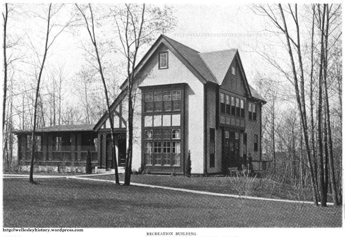
Walking through charming lawns, dotted by magnificent trees, we came to the handsome new academy for young ladies. It is built at the rear of the old gabled house near the entrance to the grounds, and is certainly a handsome edifice, constructed in the style of a French château, the upper stories being finished outside in oiled wood. This building contains spacious classrooms, recreation and music halls, studios, dormitories, laundry, baths, etc., fitted up with all modern conveniences, and lighted throughout by electricity. Here are taught music — vocal and instrumental — painting, drawing from casts, plain and fancy needlework, domestic economy, and all the branches of a literary and scientific education.

Ample lawns have been left as recreation grounds, while the many broad acres under cultivation yield plenty of fresh vegetables, so nutritious an accompaniment to the diet of growing children; a number of poultry-yards and some twenty cows give evidence of abundance of eggs and milk, and the beautiful fresh air, at an elevation of two hundred feet above the sea affords Wellesley greater natural advantages than the majority of our institutions can boast.

One more item took my fancy. My visit was made on the glorious Fourth — or rather Fifth — and two “star-spangled banners” floated to the breeze from the gables of Wellesley. “So,” thought I, “besides all other advantages the Academy of the Assumption is an American institution!” — The Sacred Heart Review, August 7th, 1897

Needless to say, the school — just like the other academies established by the Sisters of Charity — was an immediate success. By 1898, there were 63 students. Three years later, enrollment was up to 79. This trend continued for decades.

As the enrollment grew, so did the need for space. Initially, this mostly meant adding onto the existing buildings. But in 1920, they commissioned renowned architect, Franz Joseph Untersee, to design a massive English Gothic edifice that would give no visitor — or passerby on Worcester Street — any doubt that this campus was home to a prestigious academic institution.

1921 Untersee building and Bird-Scudder Mansion (viewed from the eastern edge of the campus) Source: 1931 Semi-Centennial Booklet

Main building and Bird-Scudder mansion (viewed from the eastern edge of the campus)
Source: 1931 Semi-Centennial Booklet

Photo taken by Joshua Dorin in July 2014

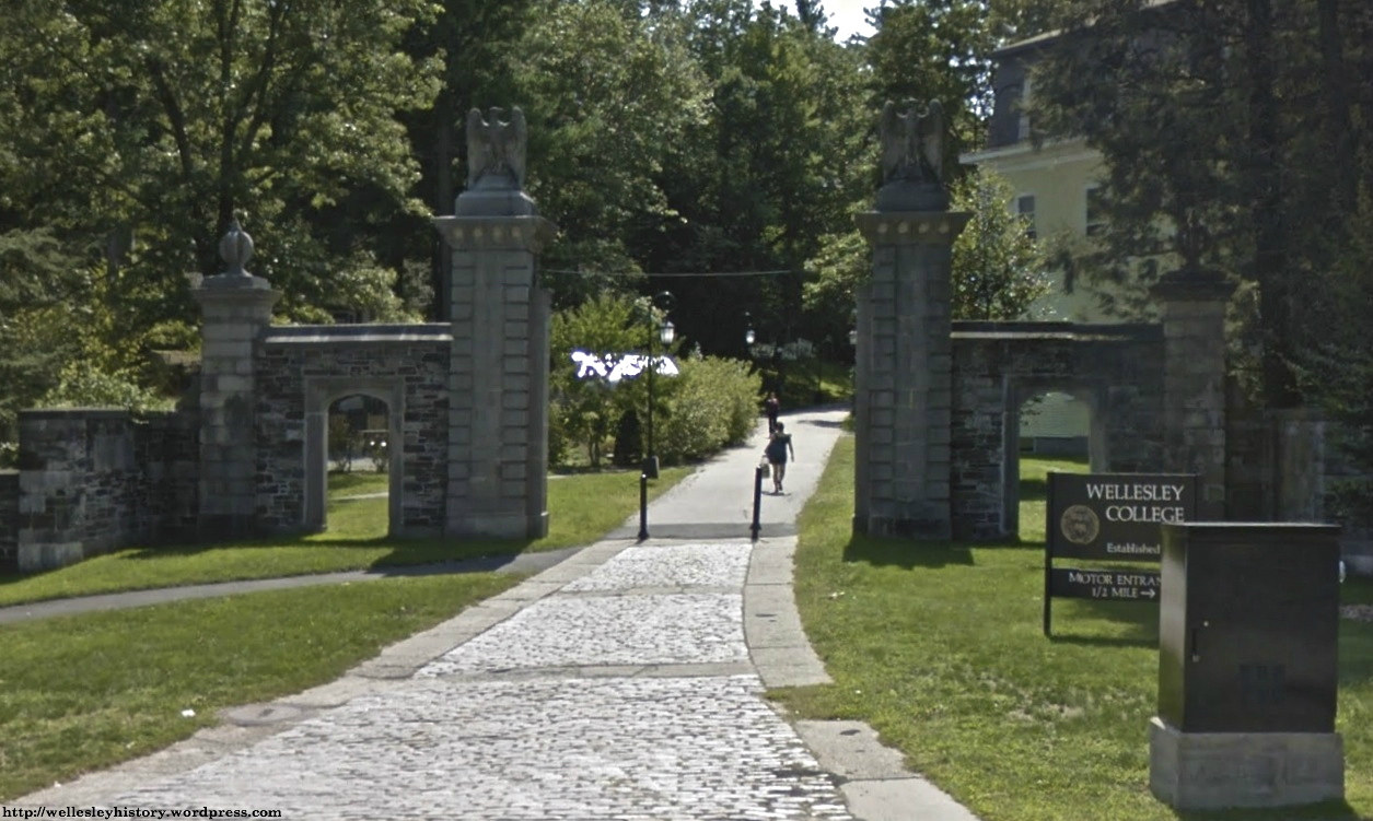
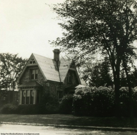
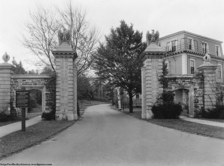
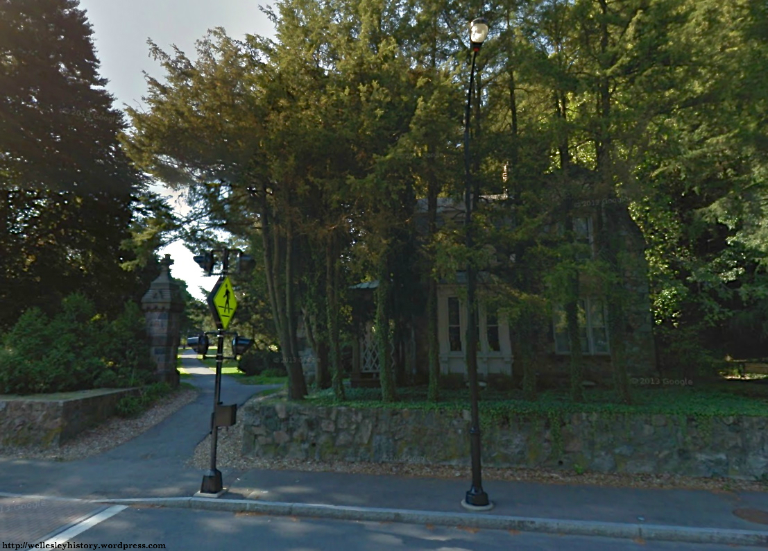
It appears likely that soon after this building opened in 1921, upon realizing the advantages of having an attractive campus that was visible from a major roadway, the Academy constructed the charming stone lodge that still stands at the intersection of Worcester and Oakland Streets. Beyond serving as a marketing ploy, this lodge provided shelter to students and staff who were waiting for trolleys on the Boston & Worcester Street Railway line.

Stone lodge

Stone Lodge at corner of Worcester and Oakland Streets 
(Originally located at street level — moved when Worcester Street became a state highway in 1932-33)

Walk through that lodge and the following campus awaited you:

Map of campus in 1922  (prior to construction of stone lodge)  Source: Norfolk County Registry of Deeds

Map of campus in 1922 (prior to construction of stone lodge) — CLICK TO ENLARGE
Source: Norfolk County Registry of Deeds

As you can see, the only structures on the map that remain standing today are the ‘New Building’ and the ‘Laundry – Powerhouse’ building.

Laundry and Powerhouse Building  Photo taken by Joshua Dorin in July 2014

Former Laundry and Powerhouse Building

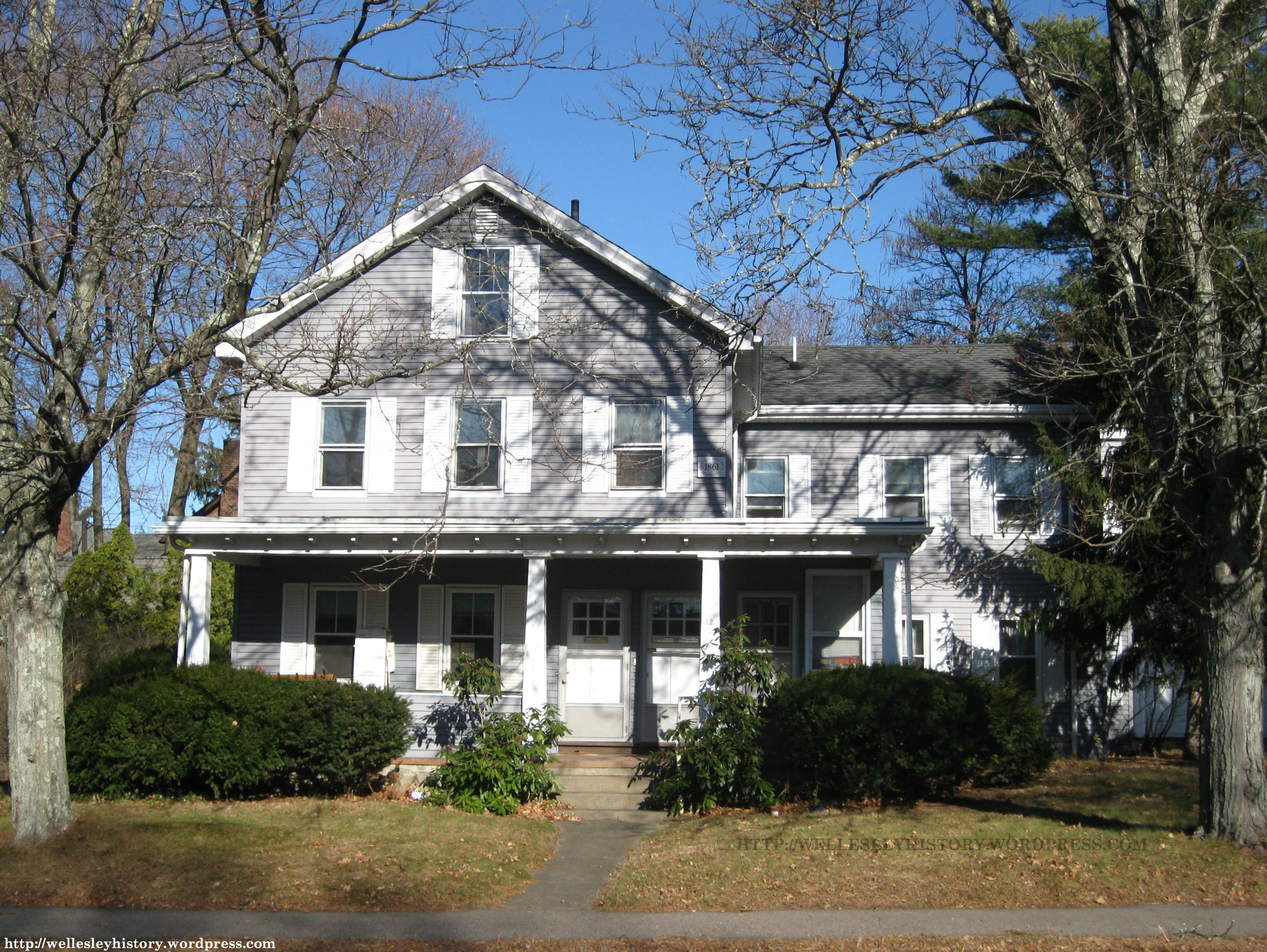
But there’s one other building from the Academy’s original campus that still stands and isn’t shown on this map: the Putney farmhouse. Located on the Academy’s 40-acre farm that it acquired the year after its purchase of the Bird-Scudder Estate (and included much of what is now the northeastern section of Wellesley Country Club’s golf course), this farmhouse served as the living quarters for the farmhands who grew the vegetables, milked the cows, fed the pigs, and collected the eggs that would end up on the plates of the hundreds of students and staff at the Academy.

The impossible-to-photograph-well Putney farmhouse at 161 Oakland Street  Photo taken by Joshua Dorin in July 2014

The Putney farmhouse at 161 Oakland Street (and a really annoying tree)

Gate on cart path that leads to former site of Academy farm  Photo taken by Joshua Dorin in July 2014

Gate on cart path that leads to former site of Academy farm

So now that we’ve described the campus, what kinds of students went to the Academy of the Assumption and St. Joseph’s Academy?

From the beginning, both schools (obviously) catered towards Catholic children living within the region. Many were from Boston. And most were relatively poor children of immigrants primarily from Ireland, Italy, and Canada. The academies therefore offered not just a superior education but also a stable living situation for these children.

Not all students, however, fit that profile. Some of them came from more affluent Catholic families, most notably Dorothy Ruth, one of Babe Ruth’s adopted daughters who attended the Academy of the Assumption during the late 1920s when the Great Bambino was playing for the New York Yankees. (He even occasionally came to Wellesley to pick her up — an event that was understandably of great excitement to the townspeople.)

Nor were all students Catholic. In fact, many Protestant children from the surrounding area, including Wellesley, attended as day students.

As the years passed by, the Academy of the Assumption continued to grow, attracting more and more students from both Wellesley and far away places (including a whole bunch from Latin America). But in many ways, it was quite similar to most other religious schools in the region. The academy wasn’t even outrageously different from the other private schools in Wellesley.

There were two annual traditions, however, that helped the school stand out within the community: the Christmas Bazaar and Field Day.

The Christmas Bazaar was exactly what it sounds like: an all-day bazaar that was held a month or so before Christmas where patrons could buy handmade gifts, needlework, toys, and religious articles. And each year, it became a larger and larger event with the addition of movies, games, lots of food, and even an appearance by Santa Claus (who would fly in via helicopter instead of sleigh).

Posted with permission from the Wellesley Townsman

(Posted with permission from the Wellesley Townsman)

The other annual tradition — which was arguably even more exciting — was Field Day. First held in the 1910s, Field Day quickly evolved from what was more or less a pleasant social gathering into an all-out competitive sporting event where students from the Academy of the Assumption and St. Joseph’s would compete against students from other Catholic schools in various activities, including foot races, baseball games, horseback riding events, and even a military drill.

Its evolution would continue until Field Day had become a full-fledged carnival featuring rides, raffles, concerts, auctions, and all sorts of games. During the 1950s and 1960s, attendance each year reached upwards of five thousand.

Posted with permission from the Wellesley Townsman

(Posted with permission from the Wellesley Townsman)

Circa 1960 photograph of Field Day  (Posted with permission from the Wellesley Townsman)

Field Day circa 1960 
(Posted with permission from the Wellesley Townsman)

Circa 1960 photograph of Field Day  (Posted with permission from the Wellesley Townsman)

Field Day circa 1960
(Posted with permission from the Wellesley Townsman)

Just as each Field Day was a resounding success, so was the Academy of the Assumption in general. Everything seemed to be looking great for the school. So much so that, once again, it needed more space and therefore constructed a large addition off the main building that included an auditorium, gymnasium, assembly hall, and more high school classrooms.

1952-53 Addition  (Posted with permission from the Wellesley Townsman)

1952-53 addition
(Posted with permission from the Wellesley Townsman)

(Photo taken by Joshua Dorin in July 2014)

But this new space proved inadequate only one decade later, and so the Academy broke ground in 1963 for a relatively huge high school building (to be named after Elizabeth Seton) that would help give the Catholic Church a prosperous future.

Rendering of Elizabeth Seton High School  (Posted with permission from the Wellesley Townsman)

Sketch of Elizabeth Seton High School
(Posted with permission from the Wellesley Townsman)

Main entrance to former Elizabeth Seton HIgh School  (Photo taken by Joshua Dorin in July 2014)

Former main entrance to Elizabeth Seton HIgh School

Former Elizabeth Seton High School  (Photo taken by Joshua Dorin in July 2014)

Former Elizabeth Seton High School

There was just one huge problem: fewer and fewer religious sisters were available to teach at the Academy. The only solution therefore was to hire (more expensive and probably not as religious) lay teachers to fill open positions.

So, in 1966, the Church began construction on the new Mount St. Vincent Sister Formation Center. One could think of this facility as more or less a mini-college where up to 150 young women would study and train to become Sisters of Charity for the Boston and New York orders. In addition, there would be living quarters for a hundred current and retired sisters.

Sketch of Mount St. Vincent Formation Center  Note that only front half of proposed building was constructed  (Posted with permission from the Wellesley Townsman)

Sketch of Mount St. Vincent Sister Formation Center
Note that only front half of proposed building was constructed
(Posted with permission from the Wellesley Townsman)

Former Mount St. Vincent Formation Center  (Photo taken by Joshua Dorin in July 2014)

Former Mount St. Vincent Sister Formation Center (now Elizabeth Seton Residence)

At first, the new high school and Formation Center looked like they just might help the Catholic Church overcome its problems. Enrollment at the high school increased. And when the Formation Center opened in late 1967, there were 20 postulants (first year students) and 18 novices (second and third year students).

Source: Mann (1945)

Different levels of Sisterhood within the Sisters of Charity of Halifax
Source: Mann (1945)

By 1971, however, the future looked less bright. Fundraising efforts to pay off the debts accrued during the construction of the Elizabeth Seton High School and the Formation Center had failed miserably. Furthermore, enrollment at the Academy was not high enough and the Formation Center was not bringing in as many teachers as the Church had hoped. Therefore, discussions to close the entire academy began.

Despite a frantic movement to save the school, it was announced in February 1971 that the academy would close after the 1971-72 school year. (By that point in time, the Formation Center had already been discontinued.)

Town officials immediately began salivating at the prospect of acquiring a vast amount of land in a nearly built up town. Proposals percolated. They could build a new high school there. Maybe construct municipal offices. Perhaps leave a large area as open space. But a vote to purchase the property for $6 million failed (82-118) at a Special Town Meeting in June 1971.

In swooped Mass Bay Community College (which was then located on the Watertown-Waltham line). Two months later, a deal was made between the Sisters of Charity and Mass Bay to sell the main part of the campus to the community college provided that the Commonwealth could allocate the money. (It did.) The 84-acre property was sold for $5,390,500 in October 1973. Despite strong objections by the townspeople, Mass Bay opened in the fall of 1974.

Of course, the Town didn’t come away empty-handed. As a consolation prize, it was able to snag 42 acres of the former Academy farm (for only $1.1 million!) in 1980 for Centennial Park, the Town’s present to itself for the approaching 100th anniversary of its separation from Needham.

Today, the only physical reminders that the Academy of the Assumption was a significant part of Wellesley for nearly eighty years are a few campus buildings and structures as well as the Elizabeth Seton Residence.

Looking back on the last few decades of the Academy’s existence, was there anything the Sisters of Charity could have done differently to prevent the outcome that occurred? I’m not really sure.

On one hand, there are plenty of Catholic secondary schools still open in Massachusetts. Why not the Academy of the Assumption as well?

The facts, on the other hand, tell a different story. Between 1965 and 2014, the number of religious sisters nationwide has dropped by 72%, the number of priests by 35%, and the number of Catholic secondary schools by 22%. We’ve even seen the declining influence of the Catholic Church elsewhere in Wellesley, with the closure of St. James the Great in 2004.

I therefore suspect that the only way the Academy of the Assumption could have survived was if the Church had not acted so foolishly with its own money in constructing the Formation Center. Yes, the Academy would have had to rely on the Catholic laity to teach. But don’t you think that’s a much better scenario than what actually happened?

Note: All color photographs were taken by Joshua Dorin in July 2014.

Sources:

  • Federal Census Reports of 1860, 1870, 1900
  • Boston Daily Globe: 31 August 1875; 19 June 1892; 12 September 1893; 29 October 1967
  • Life of Mrs. Eliza A. Seton, Foundress and First Superior of the Sisters or Daughters of Charity in the United States of America by Charles I. White (1880)
  • A Directory of the Charitable and Beneficent Organizations of Boston by The Associated Charities (1891)
  • The Sacred Heart Review: 15 September 1894; 7 August 1897; 27 August 1898
  • One Hundred Years of Progress; A Graphic, Historical and Pictorial Account of the Catholic Church of New England; Archdiocese of Boston by James S. Sullivan (1895)
  • Atlas of the Town of Wellesley, Massachusetts by Geo. W. Stadley & Co. (1897)
  • The Catholic Directory, Almanac and Clergy List by M.H. Wiltzlus Company (1901)
  • Wellesley Townsman: 29 May 1908; 28 November 1919; 16 June 1922; 14 July 1922; 4 May 1923; 22 June 1923; 12 June 1925; 18 January 1929; 23 March 1933; 1 June 1934; 29 November 1935; 3 June 1938; 24 May 1940; 18 November 1943; 18 September 1947; 30 September 1948; 21 September 1950; 24 May 1951; 29 November 1951; 14 February 1952; 22 May 1952; 19 March 1953; 23 September 1954; 12 May 1955; 23 June 1955; 24 May 1956; 20 September 1956; 8 November 1956; 25 May 1961; 16 November 1961; 23 May 1963; 31 October 1963; 12 December 1963; 17 September 1964; 2 September 1965; 19 May 1966; 23 June 1966; 26 October 1967; 14 January 1971; 28 January 1971; 25 February 1971; 24 June 1971; 12 August 1971; 26 August 1971; 8 June 1972; 11 October 1973; 5 September 1974; 15 May 1980
  • The Book of Boston by Edwin Monroe Bacon (1916)
  • The Reading Eagle: 17 January 1929
  • 1931 Booklet for the Semi-Centennial of the Town of Wellesley
  • Guide to the Religious Life: Archdiocese of Boston by Albert R. Mann (1945)
  • The Sisters of Charity of New York, 1809-1959 by Marie de Lourdes Walsh (1960)
  • Charity Alive: Sisters of Charity of Saint Vincent de Paul, Halifax, 1950-1980 by Mary Olga McKenna (1998)
  • Center for Applied Research in the Apostolate — Frequently Requested Church Statistics — accessed in August 2014
  • Norfolk County Registry of Deeds

Bonus Photo: Anyone know the origins of this cornerstone? I suspect it came from the main building of St. Joseph’s Academy, which was razed between 1969 and 1971, but I’m not 100% sure.

AcademyoftheAssumption_StJosephsbuildingfoundation_6July2014_labeled

The History of Central Street

Update from Josh (7/12/2014): Like Wellesley in the summer, this blog is dead. At least until September. Too much other Wellesley history stuff going on. If you want to receive notification of my next post, you can ‘follow’ the blog by entering in your email address into the box on the right (and clicking on a link in a confirmation email).     

There are 518 different streets in Wellesley. Their combined length: 130.12 miles. But for this post, we’re going to concern ourselves with only one of those roads — Central Street — and really all we’ll focus on is the quarter mile stretch between the Crest Road and Weston Road bridges.

Source: Bing Maps

Source: Bing Maps

Why care about such a small section of roadway? Well, quite simply, there isn’t any other street in Wellesley that has as rich a history compacted into such a short amount of time. Between 1838 when the road was laid out and the 1920s and 1930s when it took its present form, Central Street exhibited a wide range of identities: residential neighborhood, grammar school grounds, livery hub of the town, and upscale shopping district.

Perhaps this hodgepodge of land uses would not be so remarkable had there been a shortage of property on which to build in Wellesley Square. But available land wasn’t that rare, as there were large parts of both Washington Street and Church Street that were totally undeveloped throughout this time. It was therefore quite amazing that this stretch of Central Street underwent so many changes during its first hundred years.

Source: The Wellesley Legenda (1941)

Source: The Wellesley Legenda (1941) — Click to enlarge

Before we discuss the development of Central Street in more detail, let’s start with the laying out of the road. As I mentioned above, the section of Central Street we’re focusing on in this post didn’t exist until 1838. That, however, doesn’t really tell the whole story. Technically, there was a road from West Needham village (Wellesley Square) to North Natick as early as 1726. But it didn’t correspond one-to-one with what is currently Central Street. Although the part of this roadway west of Weston Road more or less followed the same route as Central Street, almost all of its eastern section is now what we know as Church Street.

And to add more confusion to the story, this older road wasn’t known as either Central Street or Church Street. In fact, throughout the 1700s and into the early 1800s, it doesn’t even seem to have had a name — as most roads at the time were only referred to by the town or village to which they led. Hence, this road was originally called ‘the road to North Natick.’

Quite frankly, I have no idea when this road was given its first official name. But if I had to guess, it would have been around 1830 when the road became part of the Central Turnpike (which ran from what is now Wellesley Hills Square to Hartford, Connecticut).

The creation of this turnpike may also explain why the part of Central Street we’re considering in this post was laid out in 1838; they were simply trying to straighten the thoroughfare. (At that point then, it is believed that people began referring to the eastern end of ‘the road to Natick’ as ‘Common Street’ before eventually settling on its present name: ‘Church Street.’)

It’s also unknown when exactly ‘Central Street’ came into usage. But 1853 seems probable given that was the year the Central Turnpike closed, suffering a similar fate to most other turnpikes in New England during the era of railroad expansion. Just as the Worcester Turnpike in Wellesley became ‘Worcester Street,’ the Central Turnpike became ‘Central Street’ (or ‘Central Avenue’).

Okay, enough with the road itself. Let’s talk buildings. For starters, take a look at the following map of West Needham village in 1856.

1856 Map of West Needham Village

1856 Map of West Needham Village

Central Street is the roadway in the middle of the map running north of the Congregational Church. And as you can see, there really wasn’t much on it at the time — three houses and a grammar school.

The oldest of these structures was the residence of Ruth Crocker (which was actually a tavern at the time that this map was made). Historically, however, the circa 1770 house is better known as the home of several generations of the Flagg family — both before and after the Crockers occupied it. Sadly, the Flaggs are all but completely unknown to Wellesleyites today despite being arguably the most active family in Town affairs from the Revolutionary War era all the way up to the turn of the 20th Century. Alas, if only a school or road had been named after the Flagg family…

The Flagg-Crocker House  (Posted with permission from the Wellesley Townsman)

The Flagg-Crocker House
(Posted with permission from the Wellesley Townsman)

You’re probably more familiar with the second oldest structure on the 1856 map — the residence of William Carhart — which is better known today as the Hathaway House and is currently occupied by the Stuart Swan Furniture Company. Built circa 1830 and now the oldest building still standing on Central Street, it was nothing more than a simple farmhouse up through 1925 when two Wellesley College professors, Julia Swift Orvis and Phillips Bradley, decided more or less on a whim to purchase and renovate the dilapidated structure and open the Wellesley Community Bookshop Cooperative (which was more affectionately known as The Hathaway House Bookshop — named for Rebeckah (Morse) Hathaway, the sister-in-law of Carhart, who had lived there from 1853 following the death of her husband until her own demise in 1916 at the age of 91).

The Hathaway House Bookshop (Posted with permission from the Wellesley College Archives)

The Hathaway House Bookshop — the official bookstore of Wellesley College from 1926 to 1976
(Posted with permission from the Wellesley College Archives)

We’ve reached the part of the post where I’m going to stop typing and let some of my readers take over. Let’s face it. My knowledge of the Hathaway House Bookshop is probably pretty skimpy compared to that of some of you. After all, I never once had the chance to set foot in the place. (It closed in 1979.) So if you feel inclined, please leave a comment below and fill me in on what I missed.

The Hathaway House  (Photo taken by Joshua Dorin in May 2014)

The Hathaway House
(Photo taken by Joshua Dorin in May 2014)

Finally, just for completeness’ sake, I need to point out that the only other house on the 1856 map above — that of Lucius Field and his wife, Mary — can be seen on the right side of the second photo in this post (at the east corner of Cross Street). This charming 1 ½ story dwelling, which was constructed during the 1840s, was torn down in 1956.

Let’s now turn our attention to the fourth and final building on the map — the grammar school — which had been constructed concurrently with the early residential development of Central Street.

This new schoolhouse — known simply as ‘West’ and serving as the only grammar school in all of what is now the western half of Wellesley — was constructed in 1840 on the triangular parcel of land bounded by Cross Street, Weston Road, and Central Street. Unfortunately, I can’t show you an image of it because it stood for only thirty years and (not surprisingly) no one seems to have bothered to photograph it.

I can, however, show you its two successors that were constructed in 1870 and 1892, respectively. In fact, I can do one better and direct you to the older of these two school buildings — it now sits just inside the gates of Wellesley College at the intersection of Central Street and Weston Road. Currently known as Fiske House, this three-story mansard-roofed structure was once the most modern schoolhouse in all of Wellesley — its construction was financed in large part by a generous donation of $10,000 from Horatio Hollis Hunnewell (who ended up getting his name put on the school).

The first Hunnewell School, however, stayed open for only twenty-two years. By the early 1890s, the residential area in and around Wellesley Square (including the College Heights neighborhood north of Linden Street) had grown large enough that they needed a school with even greater capacity. And thus the second Hunnewell School was constructed in 1892.

The 1893 Hunnewell School  (Source: 1930 Annual Town Report)

The 1892 Hunnewell School
(Source: 1930 Annual Town Report)

Snack time in kindergarten classroom at the 1893 Hunnewell School  (Source: 1930 Annual Town Report)

Snack time in kindergarten at 1892 Hunnewell School
(Source: 1930 Annual Town Report)

Here’s the part of the story that confuses me. Now that we’ve got some houses and a grammar school, who OK’d the construction of two large stables on Central Street during the 1870s and 1880s? Of course, the answer is no one. Given the absence of any zoning ordinances in Massachusetts until the early 1900s, you could build more or less whatever you wanted as long as there weren’t any deed restrictions on the property.

The larger of these barns was built by Patrick O’Connell in 1885 on the north side of Central Street (at what would become the west corner of Crest Road four years later when the bridge there was constructed).

The O'Connell stables  (Posted with permission from the Wellesley Townsman)

The O’Connell stables
(Posted with permission from the Wellesley Townsman)

In addition to housing the horses and carriages that made up Wellesley’s largest livery business, the stables were used to store all of the equipment for Wellesley’s first fire department — a volunteer force organized by O’Connell at around the time his stables were completed.

But this arrangement was only temporary. By 1890, the volunteer force had become so successful that the Town constructed its first fire station (on the north side of Church Street at the current site of the parking lot behind the former Filene’s building). The use of O’Connell’s stables to keep the horses that pulled the Fire Department’s hose wagons, however, was still required well into the 20th Century.

Okay, thus far in our story, we’ve got houses, schoolchildren, and horses. Sounds confusing. How about we look at another map to provide some visual clarity?

Circa 1910 Map of Central Street (Source: Town of Wellesley Department of Public Works)

Circa 1910 map of Central Street — Click to enlarge
(Source: Department of Public Works — Engineering Division of the Town of Wellesley)

As you can see, this map shows Central Street during the early 1900s (with labels for the houses and buildings we’ve already talked about).

Here are three key observations:

1) The eastern end of Central Street is now densely packed with houses and stables. But don’t even bother trying to compare those buildings to what is there today. None of them remain.

2) There’s also the puzzling presence of ‘Waban Street Extension.’ And where is the continuation of Abbott Street by the cemetery? Well, this actually relates to the Filene’s department store, which is discussed below, but I’ll jump ahead and give you the answer now. To make a long story short, in 1947, Filene’s — which was constructed on the site of the Bigelow stables — wanted to expand its store. But there was no room. The owner, Alfred Fraser, therefore made a deal with the Town that would allow him to build out into Waban Street Extension — which had been laid out in the 1890s to provide a shorter route between the O’Connell stables and the Church Street fire station — only if Fraser covered the costs associated with extending Abbott Street from Church Street to Central Street.

3) The changes on the western half of Central Street are much more straightforward. In fact, there’s only one structure there that we haven’t discussed: the Y.M.C.A. building. Constructed in 1901 as a clubhouse for the young men and boys of Wellesley under the direction of officials from the Wellesley Congregational Church and at the expense of Pauline Durant (the widow of Wellesley College founder, Henry Durant), this shingle-style building was typical of most social clubs of the time, containing reading rooms, a set of bowling alleys, and a gymnasium (which was supposedly the best one in town for dancing).

But the Boys’ Club (as it was known) was a flop. It seems that the young men in town preferred to socialize elsewhere and exercise outdoors. That, however, didn’t stop the Y.M.C.A. from establishing a Wellesley branch there in 1908. Not surprising, even that failed.

The men of Wellesley, however, didn’t have as much of problem with the idea of joining a social club. Two of the more popular fraternal organizations soon set up their headquarters there: the Nehoiden Club in 1911 and the Wellesley Lodge of the Independent Order of Odd Fellows in 1919.

Odd Fellows Building  (Source: Our Town -- November 1903)

Odd Fellows Building
(Source: Our Town — November 1903)

Odd Fellows Building in 1956 (Posted with permission from Wellesley Townsman)

Odd Fellows Building in 1956
(Posted with permission from the Wellesley Townsman)

Odd Fellows Building  (Photo taken by Joshua Dorin in May 2014)

Odd Fellows Building
(Photo taken by Joshua Dorin in May 2014)

The early 1920s marks the beginning of the end of this story. Faced with an absence of available space to expand the commercial district within the main part of Wellesley Square near the intersection of Washington and Grove Streets, business developers quickly began tearing down any and all structures on Central Street to make way for modern store blocks.

One of the first buildings to bite the dust was the Flagg house (as shown above) in 1923. And within almost no time at all, the entire stretch of Central Street had become completely redeveloped into one of the premiere and most popular shopping districts within the region.

(Remember, this was a few decades before suburban shopping malls, such as Shoppers’ World in Framingham, began dotting the landscape. If you wanted to buy expensive clothes or luxury goods, you pretty much had to go into the city to the flagship department stores.)

So how come Wellesley became the retail capital of MetroWest Boston? Why not, say, Natick or Lexington? Two reasons. First, there’s just the simple matter of geography: Wellesley was extremely accessible to residents living within the surrounding communities in every direction. And second — this is really important — it was at this time that Wellesley was cementing its reputation as one of the, if not the most exclusive suburb of Boston. A high-end town needed high-end stores. Combine that with the fact that Wellesley College (with its affluent student body) was only a stone’s throw away from Central Street and it’s no wonder merchants were clamoring over each other to set up shop here.

Two of these new commercial blocks deserve special attention. One of these is Filene’s, which was built on the site of the Bigelow stables in 1924. Only the second branch of the Boston-based department store — the first opened in Northampton earlier that year — Filene’s Wellesley shop was the brainchild of florist-turned-developer, Alfred Fraser, who had managed to convince the company’s owners to open a store in the suburbs. (It wasn’t a total crapshoot because Filene’s had tested its merchandise — with great success — at display shows at the Wellesley Inn for several years before that.)

Source: Wellesley College News (13 October 1927)

Source: Wellesley College News (13 October 1927)

Needless to say, Filene’s was a hit with the townspeople. The department store would expand four separate times over the next several decades — most notably as mentioned above, in 1947, when it took over Waban Street Extension.

Construction of Filene's addition on Waban Street Extension in 1947  (Posted with permission from Wellesley Townsman)

Construction of Filene’s addition on Waban Street Extension in 1947
Note the tower of the Church Street fire station at the top
(Posted with permission from the Wellesley Townsman)

Former Filene's Building (Photo taken by Joshua Dorin in May 2014)

Former Filene’s Building
(Photo taken by Joshua Dorin in May 2014)

The other commercial block on Central Street worth mentioning is the Colonial Building, built three years after Filene’s opened, in 1927, on the site of the O’Connell stables.

Newly completed Colonial Building in 1927 (Posted with permission from Wellesley Townsman)

Newly completed Colonial Building in 1927
(Posted with permission from the Wellesley Townsman)

One could think of this building as Wellesley’s first mini-mall. Just look at the list of its original tenants:

  • Marie Inc. Millinery
  • Isabel Stratton (gowns)
  • I. Miller Shoe Company (women’s footwear and hosiery)
  • Mademoiselle Brunette’s La Parisian Beauty Salon
  • Milady’s Shoppe (lingerie, needlecraft, and hosiery)
  • The Farrelly Frock Shop
  • Enwright’s Lunch
  • The Dainty Shop (ice cream parlor)
  • Dr. F. Wilbur Mottley’s dental offices
  • The American Express Company
  • The real estate firm of Lewis T. Todd Jr.
  • Le Blanc’s Taxi Service
  • Wellesley Motors, Inc. (agents of Hudson and Essex automobiles)

The centerpiece of the Colonial Building, however, was the Colonial Garage, a 24-hour parking garage capable of holding 175 cars — this being one of the first parking lots in Wellesley Square — along with the Colonial Filling Station (now Peet’s Coffee & Tea).

Several additions to the Colonial Building in the ensuing years would significantly enlarge the structure — so much so that the entire Wellesley Townsman staff and its publishing arm, the Wellesley Press, Inc. (including the printing presses) — moved there in 1930. And yet there was still enough space to put in a bowling alley.

The Bowladrome in 1948 (Posted with permission from the Wellesley Townsman)

The Bowladrome in 1948
(Posted with permission from the Wellesley Townsman)

At this point, the only other notable structure on Central Street that we have yet to discuss is the fire station at the corner of Weston Road. There isn’t, however, much in the way of a story associated with it. Built in 1928-29 (and designed by the architectural firm of Wellesley resident, Frank A. Whittemore), the fire station was a necessary improvement over the 1890 structure on Church Street, which had long since fallen into disrepair.

But what makes the fire station special — as was the case with most of the buildings constructed by the Town during the 1920s and 1930s — is that significant care was taken to “add something to the beauty of the town.” I’d say they succeeded.

The Central Street Fire Station  (Source: 1931 Wellesley Semi-Centenniel pamphlet)

The Central Street Fire Station
(Source: 1931 Wellesley Semi-Centennial pamphlet)

The Central Street Fire Station  (Photo taken by Joshua Dorin in May 2014)

The Central Street Fire Station
(Photo taken by Joshua Dorin in May 2014)

Our story ends in 1939. It was at that time — with the razing of the 1892 Hunnewell School and the construction of a long block of stores (and the parking lot to the rear) — that Central Street had more or less completed its transformation into the commercial district we’re all familiar with.

Source: The Wellesley Legenda (1950)

Source: The Wellesley Legenda (1950)

Source: The Wellesley Legenda (1950)

Source: The Wellesley Legenda (1950)

So what you see today is more or less how it looked during the 1940s and 1950s.

And who would have thought that such a short street would be so rich with history?

Sources:

  • An Act to Establish the Central Turnpike Corporation (1824)
  • Map of Needham, Massachusetts by Henry Francis Walling (1856)
  • Atlas of Norfolk County, Massachusetts by W.A. Sherman (1876)
  • Annual Town Report of the Town of Wellesley: 1884; 1885; 1930
  • Atlas of Norfolk County, Massachusetts by E. Robinson (1888)
  • Atlas of Wellesley, Massachusetts by George W. Stadley & Co (1897)
  • Our Town: November 1903
  • Wellesley Townsman: 9 October 1908; 5 May 1911; 12 May 1911; 13 September 1913; 4 February 1916; 27 June 1919; 4 January 1924; 26 September 1924; 3 October 1924; 25 September 1925; 27 August 1926; 17 September 1926; 15 July 1927; 9 December 1927; 20 July 1928; 17 October 1930; 13 October 1939; 10 April 1941; 14 May 1942; 23 June 1944; 4 September 1947; 18 September 1947; 15 January 1948; 24 May 1956; 5 July 1956; 30 June 1960; 22 August 1968; 5 July 1979; 2 April 1981; 19 July 1984
  • History of Needham, Massachusetts: 1711-1911 by George Kuhn Clarke (1912)
  • History of the Town of Wellesley, Massachusetts by Joseph E. Fiske (1917)
  • The Turnpikes of New England by Frederic J. Wood (1919)
  • Wellesley College News: 13 October 1927
  • Wellesley Semi-Centennial pamphlet (1931)
  • The Wellesley Legenda: 1941; 1950
  • Accepted/Unaccepted Streets in Wellesley, Massachusetts (in October 2012) by the Department of Public Works – Engineering Division of the Town of Wellesley
  • Bing Maps
  • Department of Public Works – Engineering Division of the Town of Wellesley
  • Norfolk County Registry of Deeds
  • Wellesley College Digital Archives

Channing Sanitarium

Why is it in this nineteenth century of refinement and enlightenment that one person out of every three hundred is doomed to become a mental wreck, a cipher, a nonentity, to be wiped off the surface of the earth? Have we exhausted every possible means of knowledge? Cannot something still be done to avert this black cloud of intellectual decay? — Walter Channing, M.D. (1880)

Walter Channing (1849 - 1921) </br>  Source: A History of Brookline (1906)

Walter Channing (1849 – 1921)
Source: A History of Brookline (1906)

I’m guessing you’ve probably never heard of Dr. Walter Channing. Why would you? Even within the field of psychiatry, he’s relatively unknown. A surprising fact considering — as evident from the quote above — he was in the vanguard of medical professionals during the late 19th and early 20th Centuries who sought to alleviate the symptoms of mental illness. It was only through their efforts that society began to view those suffering from psychological disorders not as criminals, but as patients who needed proper treatment.

Before we get to Walter Channing — and the nationally-recognized sanitariums he established in Brookline and Wellesley — let’s expound a little bit about the general state of mental health treatment when Channing arrived on the scene in the mid-1870s. At that time, within the United States, facilities dedicated to the treatment of mental illness were relatively rare. In fact, those people with symptoms of severe mental disorders were far more likely to be sent to a local almshouse where the living conditions were nothing short of deplorable:

Of all spectacles of human misery which the light of day looks upon, we suppose that of the lunatics in American almshouses is the most pitiable. Unlike many sufferers under the great evils of society, they are often persons who have been in better circumstances, and who must, in their dim way, feel and see the abuses of their treatment. In the country poorhouses, they are treated as lunatics were a hundred years ago in Europe. They are chained, put in cages, beaten, kept in dark holes, without fire, often naked, their food reached to them as to beasts, their clothes seldom changed, without bedding, except straw, left in their own filth, and eaten by parasites. –The Nation (1876)

But even the asylums that had been established by that time were not all that different, consisting of nothing more than “a rampart of iron bars, strong enough to confine lions and tigers in a menagerie.” Pretty much the only way someone suffering from a severe mental illness could receive proper treatment was to hire a physician to provide such care within one’s own home — an option that was only available to the wealthy.

It was therefore crucial that psychiatrists — or “alienists” as they were known back then — work to develop humane procedures and practices that could help mentally ill patients overcome their problems, or at the very least, find some sense of comfort. One of those alienists was Walter Channing, a Harvard-trained physician who worked at several asylums before opening the “Private Hospital for Mental Diseases” at the base of Fisher Hill in Brookline in 1879.

Compared to most of the other asylums in the region, Channing’s sanitarium was unique in the treatment it prescribed. Due to the relatively small number of patients — 25 or so appeared to be the maximum at any time — its doctors and nurses were able to provide individualized treatments that focused more on routing out the cause of the illness rather than merely suppressing its symptoms. How this was accomplished required not only occupational therapy and other physical therapies (such as hydrotherapy, massage therapy, and electrotherapy), but also a somewhat primitive form of modern psychotherapy. As Walter Channing explained, alleviating mental illness relied on more than just medical knowledge:

The psychiatrist must be a man, I believe, who is willing to take upon himself some of the duties of the parish priest, and not only know the physical conditions under which his patient lives, but the moral as well. He must be a humanist, patient and painstaking and willing to wait to solve problems relating to the inner life of his patient. The man of pure science can see only one side, just as on the other hand the philanthropist has only a limited outlook. It is a combination of some of the qualities of both which enable a man to most successfully treat mental cases.

Another relatively pioneering approach that Channing subscribed to was the belief that there was a benefit to employing female nurses over male orderlies. I know it sounds terribly sexist, but as Dr. Lloyd Vernon Briggs (the Secretary of the Massachusetts State Board of Insanity) explained, “…the softening, refining influence of woman, with her gentle and soothing touch which has proved so efficacious in the general hospitals for the sick, should minister with equal advantage to certain classes of unfortunate dements who, although denizens of the realms of hallucinations and delusions, are yet amenable to kindness and gentle ministration.”

Little seemed to change at the sanitarium when Channing moved it from Brookline to Wellesley in 1916. Although the reasons for moving are unclear, I’m guessing that it had to do with the rapid development of Brookline that had begun during the 1890s and accelerated post-1900. Fisher Hill was just no longer conducive for a sanitarium. Much of Wellesley, however — including the area around Great Plain and Wellesley Avenues (now part of the Babson College campus) — was still largely undeveloped.

Channing Sanitarium (in Wellesley) originally consisted of seven buildings — all designed by the nationally renowned architectural firm of Kilham & Hopkins.

Source: The American Architect (1917)

Source: The American Architect (1917)

Bird's-eye view of the former Channing Sanitarium campus Great Plain Avenue runs along the bottom of the image and Wellesley Avenue at the top Source: Bing Maps

Bird’s-eye view of the former Channing Sanitarium campus
Note Great Plain Avenue running along the bottom of the image and Wellesley Avenue at the top
Source: Bing Maps

Simply put, this sanitarium wasn’t your typical insane asylum. Patients weren’t confined to cell-like rooms, but rather encouraged to walk among the surrounding woods. Each also had his or her own private suite with its own living room, bathroom, and open-air sleeping porch. (Eight of the twenty-four suites also had an indoor bedroom.)

Source: The American Architect (1917)

Source: The American Architect (1917)

Patients' Building (small suites) in April 2014

Patients’ Building (small suites) in April 2014

 Source: The American Architect (1917)

Source: The American Architect (1917)

Source: The American Architect (1917)

Source: The American Architect (1917)

Patients' Building (large suites) in April 2014

Patients’ Building (large suites) in April 2014

Source: The American Architect (1917)

Source: The American Architect (1917)

Source: The American Architect (1917)

Source: The American Architect (1917)

The other Patients' Building (small suites) in April 2014

The other Patients’ Building (small suites) in April 2014

The other Patients' Building (large suites) in April 2014

The other Patients’ Building (large suites) in April 2014

In addition to the four dormitories, there were three other buildings on the sanitarium grounds: one housing administrative offices, a service building (presumably where many of the employees resided and the only of the seven original buildings no longer standing), and a third used for both recreation and treatment.

Source: The American Architect (1917)

Source: The American Architect (1917)

Administration Building in April 2014

Administration Building in April 2014

Source: The American Architect (1917)

Source: The American Architect (1917)

Source: The American Architect (1917)

Source: The American Architect (1917)

Recreation Building in April 2014

Recreation Building in April 2014

Source: The American Architect (1917)

Source: The American Architect (1917)

Source: The American Architect (1917)

Source: The American Architect (1917)

Source: The American Architect (1917)

Source: The American Architect (1917)

Floor plan of basement -- Recreation Building Source: The American Architect (1917)

Floor plan of basement — Recreation Building
Source: The American Architect (1917)

There were also two identical cottages that were added to the west side of this campus at some point soon after the sanitarium opened.

One of two cottages in April 2014

One of the two identical cottages in April 2014

Separate from the main campus, there were also several houses owned by the sanitarium on Great Plain and Wellesley Avenues where many of its doctors and nurses lived. (Three of those houses — 107 Wellesley Avenue and 90 & 102 Great Plain Avenue — had previously been part of the Fuller family estate and were the only three structures on the entire 50-acre grounds of the sanitarium when Channing purchased the property in 1903.)

Former nurse dormitory at 107 Wellesley Avenue in April 2014

Former nurse dormitory at 107 Wellesley Avenue in April 2014

So where exactly was the entrance to Channing Sanitarium? Well, if you look closely, you can actually still see it on the right side of Wellesley Avenue as you head from the rotary towards Babson College (opposite another sanitarium-owned house at 128 Wellesley Avenue). And if you’re really adventurous, you can try to walk up this driveway, which is believed to have been closed to vehicular traffic since 1969.

Abandoned driveway of Channing Sanitarium in April 2014

Abandoned driveway of Channing Sanitarium in April 2014

Abandoned driveway of Channing Sanitarium in April 2014

Abandoned driveway of Channing Sanitarium in April 2014

OK, enough with the buildings and grounds. What do we know about the patients? Well, by and large, the vast majority of them were middle-aged or elderly women — mostly widowed or single, but there were a few who were married at the time — and their average length of stay was at least five years. There’s also no evidence that very many Wellesley residents were ever committed to the institution; in fact, approximately half of its patients appear to have come from outside of New England.

Unfortunately, the stories of most of these patients — specifically, what caused them to break down mentally and then how they responded to treatment — are a complete mystery.

There are a few patients, however, about which we know at least a little something.

Let’s start with Annie Tyler Rice (c.1867 – 1950), an elderly spinster from Beverly, Massachusetts who spent the last 20 years of her life at Channing Sanitarium. Apparently, her only “condition” was that she had become an invalid and was thus unable to live alone. But Rice must also have been quite a recluse. How else can you explain that when she died in 1950, nobody knew that her estate was worth a whopping $6.4 million (or nearly $60 million in 2014 dollars)? Perhaps she was even unaware of her vast wealth given that she died intestate. (Rice must have inherited this money from her brother, Charles G. Rice, a mining and smelting magnate, who had died seven years earlier. The courts ended up awarding her estate to her niece and two nephews.)

And then there was Elise Hall (1853 – 1924), the first woman in the United States to play the saxophone. Her affinity for the instrument began in the 1890s when she was living in Santa Barbara, California. A serious case of typhoid fever had caused Hall some hearing loss, so her doctor’s “prescription” was to find a wind instrument and blow out her ears. Oddly enough, a saxophone was all that she could find. When Hall and her family returned to Boston in 1898, she took her obsession with the saxophone to the next level. She began taking lessons with Georges Longy, the principal oboist of the Boston Symphony Orchestra (and eventual founder of Cambridge’s Longy School of Music), and even helped form the Boston Orchestral Club, an elite group of musicians — including herself — that commissioned and performed works from world-renowned composers, including Claude Debussy and Andre Caplet.

Not everyone, however, viewed her notoriety as a concert saxophonist with admiration. One of those was her son-in-law, Benjamin Loring Young, the Speaker of the House in the Massachusetts Legislature, who felt that the public’s fascination with Hall could hinder his political ambitions. To Young, there was just something strange and unflattering about a woman playing the saxophone in the early 1900s. Combine that with her other eccentricities — such as the time that she brought to a dinner party a piglet she hoped to cook — and it’s not that surprising that Young had his mother-in-law committed to a few different institutions, including Channing Sanitarium, where she spent the last three years of her life. (I suppose, however, it was karma that Young was unsuccessful the only time he ran for national office — as the Republican nominee for the U.S. Senate in 1928.)

Our third and final patient was Starr Faithfull (1906 – 1931), an attractive young socialite whose tragic life story — including a brief stay at Channing Sanitarium — attained widespread notoriety when her badly bruised body was found washed ashore on Long Beach in New York. (The novel and Hollywood movie, BUtterfield 8, was based on her life and garnered Elizabeth Taylor her first Academy Award.)

Born into a wealthy and prominent family (as Marian Starr Wyman), Faithfull voluntarily committed herself into Channing Sanitarium in the mid-1920s after finding herself on the verge of a mental breakdown — a result of the sexual abuse she suffered at the hands of Andrew James Peters, her elder cousin (by marriage) and Mayor of Boston from 1918 to 1922. The details are quite disturbing. Starting when she was only 11 years old, Peters would drug her with ether to break down her resistance to his sexual advances, culminating in rape by the time she was in her late teens. He even built a house for his cousin in Dover at 9 Old Colony Drive, across town from his family’s estate, where he could sexually assault her on a regular basis.

This abuse continued until Starr Faithfull was in her early 20s. And although Peters was caught in 1924, he paid her family to keep the matter private and was never prosecuted for his heinous crimes. Faithfull, however, was permanently scarred and, despite the mental health treatment she sought, little could help her. She spent the remaining years of her short life abusing drugs and alcohol, falling in and out of deep bouts of depression. Many people therefore suspected her death was a suicide. (Several suicide notes were found, but their authenticity was inconclusive.) Other investigators suggested that the 25-year-old had simply fallen overboard and drowned. A few even made accusations that she was murdered. To this day, the death of Starr Faithfull remains a mystery.

——

Channing Sanitarium would close in 1951 after its acquisition by Roger W. Babson, founder of the Babson Institute. Although Babson intended at first to keep the sanitarium operational — as he was always fascinated by “the relationship between the physical condition of the average man’s brain and the efficiency of his work” — the plans quickly changed to establishing a graduate school there. But even that idea never came to fruition as the increasing enrollment of the Babson Institute necessitated the use of the facility’s buildings for faculty and student housing. The former sanitarium is now known as Woodland Hill.

It’s a shame they didn’t keep the original name, if only so that Walter Channing wouldn’t have become a complete unknown. Well, to be precise, he’s actually somewhat well-known for his expert analyses on the insanity of Charles J. Guiteau and Leon Frank Czolgosz, the assassins of U.S. Presidents James A. Garfield and William McKinley, respectively. But that’s a separate story. When it comes to Wellesley and Brookline, his legacy has all but disappeared.

Nevertheless, Walter Channing was a pioneer within the field of psychiatry, one of the few voices that spoke out against the barbaric treatment that was prevalent in asylums throughout the United States and helped to develop a medically-based approach to combating mental illness that was both humane and successful. And if that’s not worth honoring, I don’t know what is.

Sources:

  •  Diseases of the Mind by Charles Follen Folsom (1877)
  • ‘The Treatment of Insanity in its Economic Aspect’ by Walter Channing in Journal of Social Science, Vol. 13 (1881)
  • Atlas of the Town of Brookline, Massachusetts by G.W. Bromley & Co. (1893)
  • Atlas of the Town of Wellesley, Massachusetts by George W. Stadley & Co. (1897)
  • ‘Dispensary Treatment of Mental Diseases’ by Walter Channing in The American Journal of Insanity, Vol. 58 (1902)
  • A History of Brookline, Massachusetts (1906)
  • Wellesley Townsman: 13 April 1906; 19 February 1915; 19 November 1915; 28 June 1951; 10 April 1952; 29 May 1952; 3 April 1969
  • ‘Restraint Instead of Treatment’ by L. Vernon Briggs in Boston Medical and Surgical Journal, Vol. 162 (1910)
  • Federal Censuses of 1910, 1920, 1930 & 1940
  • The Institutional Care of the Insane in the United States and Canada, Vol. 2 by Henry Mills Hurd (1916)
  • The American Architect, Vol. 112 (1917)
  • The New England Journal of Medicine, Vol. 185 (1921)
  • Boston Daily Globe: 25 November 1921; 10 June 1931; 30 July 1943; 19 January 1951; 1 September 1991; 12 March 2000
  • New York Herald Tribune: 10 June 1931; 16 June 1931; 30 June 1931; 24 July 1931; 19 January 1951
  • ‘Lloyd Vernon Briggs, M.D., 1863-1941’ by Winfred Overholser in The American Journal of Psychiatry, Vol. 98 (1941)
  • Newsday: 11 March 1980
  • The Passing of Starr Faithfull by Jonathan Goodman (1996)
  • Wikipedia.org [Andrew James Peters; Benjamin Loring Young; United States Senate Election in Massachusetts, 1928]
  • Findagrave.com: Starr Faithfull
  • Norfolk County Registry of Deeds
  • Wellesley Historical Commission files: #107 Wellesley Avenue

Note: All 2014 photographs above were taken by Joshua Dorin. 

Wellesley’s Railroad Stations

Step a few feet off the road leading from Town Hall to the post office and you’ll discover two long lost relics among the trees and weeds beside the railroad tracks:

Lamp post #1  (Photo taken by Joshua Dorin in March 2014)

Lamp post #1
(Photo taken by Joshua Dorin in March 2014)

Lamp post #2 (Photo taken by Joshua Dorin in March 2014)

Lamp post #2
(Photo taken by Joshua Dorin in March 2014)

Hmm….what are two rusty old lamp posts doing here??? To answer that question, take a look at the following photograph:

NYCStationWellesleyMA_cNov1958_DickLeonhardtFlickr_labeled

The old Wellesley station circa November 1958
(Posted with permission from Dick Leonhardt)

This makes me sad. It’s the old Wellesley station, which stood on the current site of the post office from 1889 until the structure was torn down — to the disbelief and outrage of many Wellesley residents — in 1962. All that was left standing were those two lamp posts, which you can sort of make out at the far end of the platform. (It might, however, be easier to compare them to identical ones on the right side of the image.)

The story about the construction of this stone station (and three others within Wellesley that closely resembled it) is rather complex. It wasn’t as if the Town just decided to build attractive railroad depots. In fact, outside forces — specifically the Boston & Albany Railroad Company — played the primary role in bringing them to Wellesley.

But before we delve into their construction, let me use this opportunity to provide a brief history of the railroad in Wellesley. After all, the first train came through town more than fifty years before these stone stations were constructed. It should also help you understand how the evolution of the town’s railroad stations mirrored Wellesley’s development into an affluent suburb.

The Arrival of the Railroad in Wellesley

The earliest form of steam-powered rail transportation arrived in the United States in the mid-1820s. Only several years later, in 1830, the first railroad line in the country — the Baltimore and Ohio Railroad — began service. Why the railroad became so popular so quickly is not difficult to understand. It was waaaay faster than traveling by stagecoach. But more importantly, especially to the American Industrialists, raw materials from the West and the South could now be shipped to the manufacturing centers in the Northeast much more efficiently than via canals and waterways.

One of the other early railroad lines was the Boston & Worcester Railroad, which opened from Boston to Newton in April 1834. Three months later, the track had been extended through Wellesley with stops established at Rice’s Crossing (Wellesley Farms), North Needham (Grantville/Wellesley Hills), and West Needham (Wellesley [Square]). It reached Worcester in mid-1835.

A separate line — the Western Railroad — stretching from Worcester to Greenbush, NY (outside of Albany) was constructed four years later, thus connecting Boston with the Hudson River and the West. In 1869, the Boston & Worcester Railroad Company consolidated with the Western Railroad to form the Boston & Albany Railroad Company.

So what was the immediate impact of the railroad on life in Wellesley? Probably not as much as you’d think. Remember, Wellesley was sparsely populated at that time and its village centers were almost non-existent. The vast majority of its residents lived on small farms scattered throughout the area. Most of the others worked in small factories, primarily in Lower Falls. With the exception of the occasional trip into Boston to buy supplies or a visit to relatives out West, life for these residents didn’t seem to change a whole lot.

But over the next three to four decades — especially in the years following the Civil War — Wellesley underwent a noticeable change as a result of the railroad. Although the town overall still very much stayed a small farming community, more and more businessmen and professionals from Boston were settling in Wellesley. Given its proximity of only twelve miles to the city, Wellesley was close enough for a quick commute by train into downtown Boston yet far enough out in the country to establish a serene estate. The impact of these men — who included Horatio Hollis Hunnewell, William T.G. Morton, Henry Fowle Durant, Josiah Gardner Abbott, and Gamaliel Bradford Sr. — would increase in the decades leading up to Wellesley’s incorporation in 1881 as they began to use their influence and wealth to shape the community as they saw fit.

The Railroad Stations of Wellesley (1834 – 1885)

The earliest record that I can find of any railroad station in Wellesley comes from a drawing of the West Needham (Wellesley) station dated 1847:

WestNeedhamStationAChartandDescriptionoftheBostonandWorcesterandWesternRailroadsWilliamGuild1847_lab

Note: Etherton Cottage, the summer residence of Dr. William T.G. Morton that was located on the current site of Town Hall, can be seen to the left of the station.
Source: Guild (1847)

It also appears that there was a depot at the North Needham (Grantville/Wellesley Hills) stop by 1852. But given its similarity in size and form to the West Needham station, I’m guessing that the North Needham depot was built in conjunction with the construction of the West Needham station.

North Needham/Grantville/Wellesley Hills station circa 1884 Source: Bradford (1928)

North Needham/Grantville/Wellesley Hills station circa 1884
Source: Bradford (1928)

Crazy fun fact: This North Needham station still exists. It was moved down Washington Street and converted into a duplex house to make way for the construction of the current Wellesley Hills station in 1885-86.

404 Washington Street

Former North Needham/Grantville/Wellesley Hills station (now 404 Washington Street)
(Photo taken by Joshua Dorin in March 2014)

Here’s the confusing part: there was a third station in Wellesley by 1852, but it wasn’t at Rice’s Crossing (Wellesley Farms) or even on the B&A mainline at all. It was actually in Lower Falls, just south of Washington Street more or less on the site of (the Italian restaurant) Papa Razzi. This stop wasn’t established until 1846 when a short spur that branched off the mainline at Riverside was constructed to serve Newton Lower Falls and Wellesley Lower Falls. It only had two stops: ‘Pine Grove’ (in Newton) and ‘Newton Lower Falls’ (in Wellesley). (There’s so much more to be said about the railroad in Lower Falls — which was in operation up through the early 1970s — but I’m going to save that for a separate post.)

The importance of these three stations to Wellesley life cannot be understated. They weren’t just places of shelter while waiting for a train. Rather each station often served as the post office and may even have had a small store within. But perhaps most significantly, they all served as some of the first social gathering spots within each village, as Gamaliel Bradford Jr. describes (in reference to the Grantville station during the 1850s and 1860s):

Before leaving the railroad station, which at that time, when there were no clubs, might regarded as the heart of the town, I must advert to one very piquant and characteristic figure, that of Mr. Charles Kingsbury…He was a great haunter of the station and loved to sit with a bevy of cronies and discuss all the affairs of the community, great and small. If their talk had been recorded by dictagraph, it would probably be astonishing and amusing, a sort of anticipation of the personal columns of The Townsman, less decorous and exact than the pages of that estimable sheet, but with a breeziness and spiciness which do not often get into print.

The North Needham (Grantville/Wellesley Hills) and Lower Falls wooden stations both survived until the 1880s when they were replaced by handsome stone depots (see below). The West Needham (Wellesley) stop also got its own stone depot at that time, but prior to that in the 1850s or 1860s, the old wooden station had been replaced with a larger and more elegant frame structure. The reasons for this are unclear, but my guess is that it probably had something to do with the fact that the village of West Needham (what is now Wellesley Square) was beginning to develop into a mini town center. An improved train station that fit with the growing affluence of the area was therefore necessary.

Another crazy fun fact:  This more elegant frame station was spared destruction when the stone depot replaced it in 1889. Instead of tearing it down, the building was moved across the tracks and a bit eastward where it became a freight house for the B&A. In 1958, that former station was sold to the president of Wellesley Refrigerator Sales and Service, Inc. (who had been leasing it for use as a warehouse for the previous four years). Today, the former depot is occupied by Captain Marden’s Seafoods.

CaptainMardens_21March2014_labeled

Former West Needham station (now 285 Linden Street)
(Photo taken by Joshua Dorin in March 2014)

As for the stop at Rice’s Crossing (Wellesley Farms), it doesn’t appear that there was any station there. Just what’s called a ‘flag stop’ — where those waiting for a train could take shelter until a railroad attendant could signal a passing train to stop. This flag stop was located on the other side of the Glen Road bridge from the current station at the rear of the property of Charles Rice.

There was also one other flag stop in Wellesley — at Lake Crossing on the mainline near the Wellesley-Natick border. Unfortunately, little is known about this stop. My guess is that it was established soon after Henry Wood opened his cement factory on Paintshop Pond after purchasing the mill site in 1847. Near to the end of the 19th Century, a wooden station was constructed at this stop. Its fate is unknown.

The Railroad Stations of Wellesley (1886 – present)

How and why four stone railroad stations were built in Wellesley between 1886 and 1894 is a small part of a much larger story that extends far beyond the town’s borders.

We’re actually going to begin this chapter in the early 1880s, a few years before the construction of the first stone depot in Wellesley. At the time, the Boston & Albany Railroad was as popular as ever; it was arguably the primary reason why towns to the west of Boston — specifically, Brookline, Newton, and Wellesley — were becoming full-fledged suburbs.

But there were several villages in Newton that weren’t on the mainline and wanted access to the railroad. The B&A thus decided to expand its commuter service, constructing the so-called Newton Circuit — a commuter branch off the mainline that allowed residents of Brookline and Newton living in such villages as Longwood, Chestnut Hill, Newton Centre, Newton Highlands, and Waban to take the train into Boston. (This circuit was closed in 1959 and converted to light rail transit. It is now the Green Line “D” Branch of the MBTA.)

Newton Circuit

Map showing the Newton Circuit
Source: Map of the Railroads of the State of Massachusetts (1898)

It was partly because of this increase in commuter traffic that the B&A adopted an ambitious station improvement plan along both the Newton Circuit and its mainline. The primary contributing factor, however, was a newfound appreciation for the role that railroad depots play within suburban communities, as urban planning pioneer Charles Mulford Robinson explains within his 1904 essay, Suburban Station Grounds:

To the commuter using a suburban railway the erection of pretty stations and the beautifying of their grounds is a matter of great concern. It means the extension of the home atmosphere quite to the railroad track. When he steps off the train he is at home, — as far as the soothing calm of a lovely scene can make him, — without having still a quarter mile of dreary trudging before there comes heart’s-ease.

Now contrast that ideal with the following description of the Wellesley station and grounds during the 1850s and 1860s (which hadn’t changed by the mid-1880s):

It was formerly remarked by strangers getting off at the station that the outlook “made one homesick.” The conditions warranted the criticisms. Almost anything served in those days for a country railroad station, and the one that did duty in this village in the ‘50’s and ‘60’s was a pretty common affair. It was flanked on the right, not as now by a fine bit of landscape, but by a row of coal sheds which stood in a sandy depression between the Aqueduct and the railroad tracks. This place has since been filled and graded and is now a part of Hunnewell Park. On the left of the station was an old building where the firewood was prepared and stood for the use of the locomotives. The wood was sawed by horse-power. A horse was hitched to a big draw-bar, driven round in a circle and a series of cog-wheels and pulleys transmitted the power to the saw. This method of cutting up wood furnished perennial amusement to the boys, who were delighted to get into the building on every opportunity and drive the horse while they rode on the draw-bar.

Not exactly the first impression that Wellesley’s forefathers dreamed of. You can therefore understand the excitement when the B&A decided to build new stations within the town.

In total, the Boston & Albany Railroad commissioned the construction of 32 stations in Massachusetts and New York between 1881 and 1894. That’s certainly impressive. But we probably wouldn’t be talking about them all that much if it weren’t for whom the B&A hired to design the stations and grounds: Henry Hobson Richardson and Frederick Law Olmsted.

Quite simply, Richardson and Olmsted were the leading professionals in their respective fields of architecture and landscape design. Even those who know absolutely squat about those subjects are familiar with their most famous works: Trinity Church in Copley Square and New York City’s Central Park.

Henry Hobson Richardson  (Source: )

Henry Hobson Richardson (1838 – 1886)
Source: The Cincinnati Astronomical Society (1914)

Frederick Law Olmsted  Source:

Frederick Law Olmsted (1822 – 1903)
Source: Olmsted & Ward (1912)

So how exactly did the B&A obtain the services of both H.H. Richardson and Frederick L. Olmsted? One word: connections. Richardson had been good friends with James Augustus Rumrill and Charles Sprague Sargent, both members of the Board of Trustees of the B&A, since the 1860s when all three had been classmates at Harvard. As for Olmsted, he had worked closely with Sargent to design the Arnold Arboretum in Brookline. (In addition, Richardson and Sargent — and later Olmsted — resided within the same Cottage Street neighborhood in Brookline.)

Of the 32 stations constructed by the B&A, however, only nine of them were designed by Richardson — a result of his untimely death in 1886 at the age of 47.

List of Boston & Albany Railroad depots designed by H.H. Richardson (with those still standing in bold):

  • Auburndale
  • Palmer
  • Chestnut Hill
  • South Framingham
  • Brighton
  • Waban
  • Woodland
  • Eliot
  • Wellesley Hills

Following Richardson’s death, the B&A commissioned the construction of 23 more stations to Shepley, Rutan and Coolidge, the architectural firm that was formed by three of Richardson’s former assistants: George Foster Shepley, Charles Hercules Rutan, and Charles Allerton Coolidge. These stations, not surprisingly, were virtually indistinguishable from the other nine, and are therefore often credited to Richardson.

List of Boston & Albany Railroad depots designed by Shepley, Rutan and Coolidge (with those still standing in bold):

  • Newton Highlands
  • Chatham, NY
  • Allston
  • Newton Lower Falls (located in Wellesley)
  • Ashland
  • Reservoir
  • Dalton
  • Springfield
  • Wellesley
  • Newton Centre
  • Huntington
  • Warren
  • Charlton
  • Brookline Hills
  • Hinsdale
  • Canaan, NY
  • Millbury
  • Riverside
  • Longwood
  • East Brookfield
  • Wellesley Farms
  • Saxonville
  • East Chatham

Does anyone else wonder how Wellesley got four stations and, say, Natick got zero? I’m not totally sure, but it probably had something to do with the influence of some of Wellesley’s elite citizens. For example, the Wellesley station — which was arguably one of the more elaborate designs in terms of both the station and the landscaping — may have been constructed as a favor for Horatio Hollis Hunnewell, a close friend and cousin of Charles Sargent. (Hunnewell was also an early financier of the railroad industry.)

It has also been suggested that the Wellesley Farms station was built at the request of Joseph Franklin Wight, a wealthy fur dealer who constructed his Carisbrooke estate (named for a castle on the Isle of Wight) in 1881 on the current site of Carisbrooke Road.

So without further ado, here are some photographs of Wellesley’s stone stations:

Wellesley Hills station — built 1885-86:

WHrailroadstation_ArchitecturalRecordVol36_1914_cropped_labeled

Source: Architectural Record (1914)

Source: Our Town (May 1902)

Source: Our Town (May 1902)

Source: Our Town (September 1903)

Source: Our Town (September 1903)

WellesleyHillsRailroadStation_front_21March2014_labeled

Photo taken by Joshua Dorin in March 2014

WellesleyHillsRailroadStation_back2_21March2014_labeled

Photo taken by Joshua Dorin in March 2014

Quick note: As you see in the images above, there used to be extensive landscape surrounding the Wellesley Hills station and extending all the way down Washington Street to the Rockland Street bridge. These plantings (along with those between the station and the Cliff Road bridge) were removed in 1951-52 for the construction of the Wellesley Hills post office and the parking lot that is now west of the station.

Wellesley station (at Wellesley Square) — built 1889:

Source: Legenda (1903)

Source: Legenda (1903)

Source: Library of Congress

Source: HABS (1959)

Source: HABS (1959)

Source: HABS (1959)

Source: HABS (1959)

Source: HABS (1959)

Wellesley Farms station — built 1893-94:

Source: Robinson (1909)

Source: Robinson (1909)

Posted with permission from Dick Leonhardt

View of Wellesley Farms station from Hundreds Road (circa January 1957)
(Posted with permission from Dick Leonhardt)

FarmsRailroadStation_labeled

Photo taken by Joshua Dorin in May 2013

Confession: I don’t have a photo of the fourth station — the ‘Newton Lower Falls’ depot in Wellesley Lower Falls. I only know of one image that clearly shows the structure, but acquiring a digital copy from the library that possesses the image requires three weeks of notice and I didn’t give myself enough time. My bad. I’ll be sure to include it in my post on the railroad in Lower Falls.

I will say, however, that the station — built in 1887 and razed in 1944 — sat on the west side of the tracks about two hundred feet north of Washington Street at the current boundary between Waterstone at Wellesley (formerly Grossman’s) and the parking lot for Tony the Tailor and Wellesley House of Pizza (among other stores). I have no idea why they demolished the 57-year-old stone station, especially given that they built a frame one in its place.

We do, however, know why the Wellesley station was razed in 1962: i) the declining ridership and resulting financial struggles of the railroad and ii) the necessity for a new stand-alone post office in Wellesley Square.

Trouble for the Wellesley station began in 1959 when the New York Central Railroad (which then owned the B&A) filed a petition with the Commonwealth — which was ultimately approved — to eliminate all commuter service within Massachusetts and abandon its 39 stations. The increasing reliability on automobiles to commute to and from work, along with the newly constructed “D line,” was just too much for the financially struggling company.

That said, there were still nearly 1000 Wellesley residents who commuted to Boston each day via train. The Town of Wellesley therefore filed a joint appeal (along with Newton, Worcester, and Springfield) with the Massachusetts Supreme Court to fight the decision of the Commonwealth’s approval of the NYCR petition to close its commuter lines. Although the Town won in the sense that commuter service, although reduced, was never completely eliminated, it actually lost — in my opinion — because the Wellesley station was sold in 1961 and torn down the following year to make room for the construction of a building for the US Post Office, which had been housed in extremely tight quarters within the Taylor Block on the south side of Washington Street in Wellesley Square.

A newspaper rack is all that is left of the Wellesley station in July 1962 (Posted with permission from Wellesley Townsman)

A newspaper rack is all that is left of the Wellesley station in July 1962
(Posted with permission from the Wellesley Townsman)

That left standing in Wellesley just two of the four Richardson stations. In the years since, however, we nearly lost the station at Wellesley Farms multiple times. After the NYCR abandoned it and then a fire gutted its wooden interior, there were several calls for the Town to demolish it. Fortunately, none of these votes passed. In 1986, the station finally received proper recognition when it was listed on the National Register of Historic Places — a result of the hard work of Matthew Kierstead, an art history student who resided in Wellesley and was saddened by the poor condition of the Farms station. It has since undergone a significant restoration.

The same cannot be said of the station at Wellesley Hills, which is in desperate need of a facelift (as seen in the photos above). Although its Washington Street side is in decent condition, the rear of the station is just depressing. A lot of the problem has to do with the placement of signs and receptacles that can easily be moved or modified. But the station itself needs help as well.

So how about, as a first step, we look into the possibility of listing the station on the National Register of Historic Places? After all, it is the only one of the four Richardson stations still standing not on the NRHP (individually or as part of a district). Even five of the eight stations credited to Shepley, Rutan and Coolidge are NRHP-listed.

Only by recognizing the history of this station, and thus honoring the legacy of the Boston & Albany Railroad, Henry Hobson Richardson, and Frederick Law Olmsted, do we stand a chance of preventing a repeat of what happened to the Wellesley station in 1962.

Sources:

  • A Chart and Description of the Boston and Worcester and Western Railroads by William Guild (1847)
  • Map of the City and Vicinity of Boston, Massachusetts by F.G. Sidney and R.P. Smith (1852)
  • Map of the Town of Needham, Norfolk County, Massachusetts by Henry Francis Walling (1856)
  • Atlas of Norfolk County, Massachusetts by W.A. Sherman (1876)
  • Boston Daily Globe: 10 January 1890
  • Atlas of Wellesley, Massachusetts by George W. Stadley & Co. (1897)
  • Map of the Railroads of the State of Massachusetts: Accompanying the Report of the Railroad Commissioners (1898)
  • Our Town: May 1902; September 1903
  • Wellesley Legenda (1903)
  • Suburban Station Grounds by Charles Mulford Robinson (1904)
  • Wellesley Townsman: 14 December 1906; 15 December 1944; 9 November 1950; 22 March 1951; 17 January 1952; 22 May 1958; 6 August 1959; 26 November 1959; 17 December 1959; 28 January 1960; 5 May 1960; 27 April 1961; 19 April 1962; 5 July 1962; 29 May 1969; 5 June 1969; 2 February 1984; 17 January 1985; 3 August 1986; 20 August 1987
  • Modern Civic Art by Charles Mulford Robinson (1909)
  • The New England Historical and Genealogical Register, Vol. 64 (1910)
  • Genealogy of the Olmsted Family in America by Henry King Olmsted and Rev. George K. Ward (1912)
  • The Evolution of the Suburban Station by J.H. Phillips in Architectural Record, Vol. 36 (1914)
  • Richardson, the Architect and the Cincinnati Chamber of Commerce Building by The Cincinnati Astronomical Society (1914)
  • History of the Town of Wellesley, Massachusetts by Joseph E. Fiske (1917)
  • Early Days in Wellesley by Gamaliel Bradford (1928)
  • Boston & Albany Railroad Station (June 1959) by Cervin Robinson as part of the Historic American Buildings Survey (HABS), accessible through Library of Congress
  • Architecture for the Boston & Albany Railroad: 1881 – 1894 by Jeffrey Karl Ochsner in the Journal of the Society of Architectural Historians (1988)
  • Norfolk County Registry of Deeds
  • Wellesley Historical Commission files: #279-283R Linden Street; #404 Washington Street

A near-lynching in a piggery by a mob of Italians in 1884

“Stretched on a pallet of old mats in a corner of the dilapidated shanty known as McIntosh’s piggery lays the water contractor, C.H. Dacey. Standing guard over him, and seated around the shanty in little groups, are some fifty Italian laborers, who have constituted themselves his captors, and in spite of all civil authority are determined to hold him until their grievances have been adjusted.” — Boston Daily Globe, October 17th, 1884

This is definitely one of the most surreal episodes in Wellesley’s history. A large mob of Italian workers kidnapped their boss and held him captive inside an abandoned piggery because of unpaid wages. But what makes this story even more fascinating (at least to me) is that it’s inextricably linked to the introduction of indoor plumbing in Wellesley. So in a sense, I get to tell two stories in one.

(What’s that? You don’t care about how Wellesley got its running water? Well, boo hoo. This is a blog about Wellesley history. I did, however, keep that part of the post relatively short, so we’ll get to the mob scene soon enough.)

The story begins in May of 1883, almost a year and a half before the near-lynching. The Massachusetts Legislature had just passed a petition by the Town of Wellesley requesting permission to construct a town well and reservoir as well as to lay down the pipes required to deliver the water to its residents both for domestic use and for the fighting of fires. (Water was also needed to hose the dirt roads to keep the dust down during the summer.) Why the newly incorporated Town chose to do this so quickly after attaining its independence was entirely a result of its desire to leave behind its days as a relatively poor farming community. Indoor plumbing was an absolute necessity for any modern suburb.

Point of clarification: Many people seem to think that the Town could tap into the Cochituate and Sudbury Aqueducts, which were completed in 1848 and 1878, respectively. The water in those conduits, however, was reserved for the residents of the City of Boston.

The creation of a water supply system in Wellesley required three steps:

  • locate an adequate supply of potable water
  • construct a pumping station and a reservoir that could hold large quantities of pumped water
  • lay pipes underground that could channel the water (via gravity) from the reservoir to the households

Accomplishing the first task was easier said than done. It wasn’t as if the Town could just pump water straight out of the Charles River or Morses Pond. (I mean, it could…but would you want to drink that?) Instead hydrologists had to find a large enough aquifer with a high enough recharge rate and certain specific soil characteristics.

After three failed attempts to locate an adequate well along the Charles River — first in Lower Falls “just below the dams” (probably around River Street), then adjacent to Echo Bridge near Newton Upper Falls, and finally around River Ridge — success was found when they tested a site 400 feet east of Cedar Street near the current location of Barton Road. The water and soil properties proved ideal and so, beginning in April of 1884, they dug a permanent well, installed the pumping apparati, and constructed the station that provided protection and access to the equipment.

BartonRoadPumpingStation_12Feb2014_labeled

Pumping Station #1 on Barton Road
(Photo taken by Joshua Dorin in February 2014)

Now tell me, how many of you actually knew about this charming little building? After all, it’s completely out of sight from Cedar Street and the only way to access it is by driving down Barton Road. But it’s actually seen more frequently than you would think, if only because its roofline is unavoidable when you’re on Route 128 — especially driving northbound — between Exits 20 and 21.

Source: Bing Maps

Source: Bing Maps

Contrast that view with a map of the area from 1897:

Source: 1897 Atlas of Wellesley

Source: 1897 Atlas of Wellesley

With the exception of the highway and the addition of several houses, there don’t seem to be very many differences. But what this map doesn’t show is that almost all of the area between Cedar Street and the Charles River — which is now heavily forested — was nothing more than a large grassy field.

(One other key difference is the disappearance of the coal shed that once sat adjacent to the pumping station. Coal, of course, was needed to power the pump that brings water out of the ground and into the reservoir.)

Speaking of the reservoir — and I probably should have mentioned this earlier — it wasn’t as if they could construct it right next to the pumping station; rather, the reservoir needed to be located at a high enough elevation so that gravity could do all of the work in channeling the water to the households scattered throughout the town (in contrast to the pumping station which had to be closer to sea level where the watertable was higher).

There was really only one possible location for the reservoir given the distribution of households at the time: Maugus Hill. (Fun fact: Contrary to what many people think, this isn’t the highest point in Wellesley. That distinction goes to a spot just north of Monadnock Road — at 337 ft — which is the primary reason that the Peirce Hill Reservoir was constructed there in 1962 following the development of the Peirce Estates.)

So now that they had a site for the reservoir, all that remained was constructing it as well as laying the thirteen miles of cast-iron pipes connecting the pumping station to the reservoir and the reservoir to all of the households. (There are 149 miles of water pipes in Wellesley today.)

So here’s where the second part of this post comes in. (Finally!) Because this work was far more labor-intensive than simply installing a well and constructing a pumping station, the contractor for the job, Cornelius H. Dacey — the protagonist in our story — had to hire upwards of a hundred men to complete the project.

The details surrounding their employment are almost as fascinating as the mob scene itself. First off, a day’s pay for each of the men was a paltry $1.25 (for 11 hours of work), which amounts to the equivalent of only 30 bucks in 2014 dollars. But perhaps more interesting than that, the workers — almost all of whom were Italian immigrants from Boston’s North End — lived in Wellesley throughout the 2-3 months it took to complete the project, taking up quarters in an abandoned three-story piggery located at what is now the southeast corner of the Wellesley High School playing fields just north of the intersection of Rice and Paine Streets. (Neither road existed at the time, but there was a cart path that led from Washington Street to the piggery.)

At first, all seemed to go well. But problems arose in mid-October after Dacey had failed to pay the laborers for weeks of work — a total that amounted to $2000. Tempers soon began to rise. Sensing that this situation could get out of control, the Water Commissioners of the Town of Wellesley immediately arranged a meeting with Dacey at 5 Cliff Road, the home of one of the Commissioners, Albion R. Clapp.

Although the meeting went well — Dacey agreed to take the train to Boston, collect the $2000, and head back to Wellesley that evening to pay the workers — trouble began after he left Clapp’s house as he made his way over to the Wellesley Hills railroad station. Apparently, a few of the laborers were loitering at the station after hearing reports that their boss was back in town. Noticing them waiting, and realizing he couldn’t board the train at the Hills station without being seen, Dacey did his best to sneak out to Natick (by carriage) to board a Boston-bound train there. But unbeknownst to him, a few of the laborers had followed him as he tried to get away and had boarded the very same train.

Chaos would ensue once the train reached Wellesley Hills. Forcibly removing Dacey from his seat, the men who had followed him — along with the help of several other workers who had been waiting at the station — pulled him off the train and dragged him down Washington Street to the piggery. One of them then placed a noose around the contractor’s neck and threw the other end of the rope over the rafters. If Dacey couldn’t pay his workers, then they would lynch him.

Why such an extreme reaction, you ask? Well, according to one of the workers:

“We are poor men who want our money. Some of us have families who have nothing to eat. We are strangers here and the traders will not trust us. It is much better to use force than it is to starve. He is inside the barn now, all comfortable and warm, and our little ones are starving at home. It is no worse for him to suffer than for us. If he will settle he can go back, if he don’t we will keep him if we have to fight. If they come with police we will not let him go. We can die here.”

Yikes! Needless to say, the town’s residents were all on edge. A mob of Italian laborers — in broad daylight! — had just kidnapped their boss and were threatening to lynch him. Crowds of curious citizens began to form near the piggery. Even children from the Shaw School on Forest Street snagged a glimpse of the scene when they were let out after their morning session.

But, let’s face it, there really wasn’t much to see. Dacey was completely out of view within the piggery, as were most of his captors. Only a few of them stood outside to act as guards. Despite the presence of witnesses to this scene:

“Some rumors that there had been bloodshed and that several bodies were lying in front of the barn, from which their friends did not dare to rescue them, got in the wind, and many a good housewife laid down last night to dream of having her throat cut before dawn.”

Little did anyone know that help was actually on the way. Almost immediately after the kidnapping took place, Albion R. Clapp, had recognized the seriousness of what was happening and traveled to Boston along with one of the other Water Commissioners, Walter Hunnewell, to ask for help from the City’s Police Department. (At the time, the Wellesley Police Department consisted of no more than one or two officers.)

Unfortunately, it took nearly twelve hours before help could reach Wellesley. First, there was the matter of finding Boston Police Commissioner Jenks, who wasn’t at the station in Scollay Square or at his residence in the South End. (Fortunately, they found him on a return trip to Scollay Square.) And then they had to muster twenty members of the police force, supply each one with two revolvers and four pairs of handcuffs, and then charter two horse-drawn omnibuses from a local livery stable to take them on the 13-mile journey to Wellesley.

They wouldn’t reach Wellesley Hills until 4am, more than three hours after leaving the police station in Boston. (Some of that delay can be attributed to the fact that one of the horses “had a fit and died” at Newton Corner. I guess finding a replacement horse at that hour was a tad bit difficult.)

At this point in the story, why don’t I turn it over to a reporter from the Boston Daily Globe whose eyewitness account of what happened next may at times border on sensationalistic journalism, but at least it makes for a good read:

Among the first to get out was Dr. Jenks, who came forth smiling with a cigar in his mouth, and proceeded to assist Captain White in getting the men in line. “Pass out more handcuffs,” said the captain. “Pass them out; we want a pair for every Italian in the ranch.”

This was arranged to suit, and then he asked the men if they had their revolvers. He received an affirmative reply, and gave the order to forward march. The steady tread of the police made the streets of quiet old Wellesley echo as they marched down Washington street attended by crowds of citizens in front and rear. They followed on nearly half a mile, and stopped on reaching a little road that branched off to the left.

“File left, march,” said the captain, and the squad turned and went down a farm road full of ruts, escorted by the light of a single lantern.

“Now, boys,” said Captain White, “if a man so much as attempts to strike you I want you to hit him back. These men are hot-blooded, and must not have any rope, or there may be bloodshed.”

Saying this he gave orders for the men to cock their revolvers, and he and Lieutenant Kendall went up and took hold of the sliding door in the end of the barn, which yielded with difficulty to their strength. When the door slid away it revealed a queer sight. Around a fire on the ground near the entrance stood four or five sentinels warming their hands, for it was getting on toward daylight, and visitors were not expected. To the left, as far as the dim light could penetrate, was a row of closely-packed human bodies lying prone in a slumber. The police hastened inside in regular order. Awakened by the noise, each Italian rose to a sitting posture like a jack-in-a-box.

“Get down, get down.” “Down with you.” “Quiet there, will you?” “Stay right where you are, if you don’t want to get hurt,” cried a score of voices issuing from under their helmets. The police brandished their clubs, but did not use them.

The warlike Italians were completely cowed by the sight of so many men in uniform, and gave in trembling with terror. The lodging-house, which is an ex-barn, has three stories, the upper part of which is reached by a ladder on the inside in front. From the upper floors whole rows of glittering eyes looked down, shining in the lantern lights like diamonds set in jet. Taking the first one they came to, the officers proceeded to put on the steel wristers, using all alike. Soon a double row of dark laborers in their picturesque garbs of corduroy and velveteen was marched outside the door, guarded by cops on either side. Two dozen had thus been disposed of when Captain White discovered that his supply of hand-cuffs was giving out. The men aloft were ordered to dress and come down, while a man was sent to Mr. McIntosh’s for a rope. It came in a few minutes and the others were marched out in single file with the line made fast to their arms. The line was secured to the right arm of the first man and the left arm of the second and so on, giving them the appearance of smoked herring strung on a stick. It was growing daylight, and gray and brindle streaks were streaming up in the east when the last man was hitched in line. While those who were tied first were waiting for their companions to join them, they indulged in several tug-of-war games, and laughed and chatted in apparent good humor. An old man was taken down from the loft shivering from sickness. When the police found his condition he was allowed to return to bed. The boarding-master and several of his assistants were also allowed their freedom. All the rest, excepting those who jumped out the back windows in the early part of the row, were drawn up in line. Two of those who escaped came back and gave themselves up, swelling the number to sixty-eight. They and the police and the crowd formed a line nearly a quarter of a mile long. The line of march was then taken up for the Wellesley almshouse [the old clubhouse of the Wellesley Country Club], over a mile away. Nearly an hour was consumed on the journey [almost surely down Forest Street]. The road ran along by side of pleasant fields and orchards. Stately maples, radiant in their crimson autumn foliage, cast showers of leaves upon them as they passed, and the rustic residents turned out in full force. Wellesley never saw such a pageant before, and will probably never see such again.”

But the story isn’t over yet!

Once they reached the almshouse, the scores of Italian workers were taken up to the main hall on its second floor where they were untethered from the ropes and asked to empty the contents of their pockets into a large milk pan (yielding numerous stilettos and other “cruel-looking blades” in addition to tobacco, matches, and about two dollars in change).

They were then lined up and Dacey picked out the eight workers complicit in his abduction, allowing for the release of the other men. At this point, there was a bit of uncertainty about what to do with the alleged culprits. Should they stay locked up at the poor farm? Or should they hold an impromptu trail right then and there?

Why the latter, of course! So a judge from Dedham was brought in, evidence was presented, and witnesses were called to testify — including Dacey, Clapp, and “a pudgy little Irishman” who witnessed the initial assault on the train.

But the judge was unable to determine the guilt of the eight defendants without the aid of a grand jury. Alas, completion of the trial would have to wait until the next session of the Norfolk County Superior Court. So bail was set at $100 for each of the men — an amount that seems almost unfair given the fact that they hadn’t been paid in weeks. Thus unable to post bail, they were hauled off to the Dedham jail where their fate remains a mystery.

As for life in Wellesley, it’s safe to assume that things quickly went back to normal. In fact, it appears that work on the Town’s water supply system was barely interrupted. So by early 1885, residents of Wellesley were able to indulge themselves for the first time in the luxury of having indoor plumbing. And eventually other amenities began to arrive in the town: electricity, telephone service, and sewerage, to name a few. But with each of those, there were no mobs, no omnibuses filled with Boston police officers, and certainly no piggeries.

So who would want to read about that?

Sources:

  • Chapter 166 of the Massachusetts Legislature of 1883: An Act To Supply The Town Of Wellesley With Water
  • Boston Daily Globe: 17 October 1884; 18 October 1884; 19 October 1884; 24 October 1884
  • Wellesley Town Reports: 1884-1886
  • The Wellesley Water-Works by Frank L. Fuller in Journal of the Association of Engineering Societies, Vol. 3-4 (1885)
  • Atlas of Wellesley, Massachusetts by George W. Stadley & Co. (1897)
  • Wellesley Townsman: 24 May 1956; 9 August 1962
  • Wellesley Historical Commission files — Pumping Station #1
  • Massachusetts Water Resources Authority website
  • Town of Wellesley website

The Gates of Wellesley College

We’re all told not to judge a book by its cover. But who are we kidding? Everyone does it.

That’s why I don’t understand the main (vehicular) entrance to Wellesley College on Central Street. Imagine for a second that you’re a prospective or incoming student who’s visiting the campus for the first time. You have just spent months, perhaps years, dreaming of attending Wellesley. You’ve read numerous reviews of the College and even taped a poster of its Hogwartsian campus to your bedroom wall. The anticipation of arriving is almost unbearable. And then when you finally get here, this is what greets you:

Source: Google Maps

Source: Google Maps

Meh.

It’s certainly not ugly. (Nor is the other vehicular entrance on Washington Street.) But it’s completely unremarkable. And for $57,042 a year — the tuition and boarding costs for the 2013-14 academic year — I’d expect a grand entrance. If not a gothic archway, then how about a set of wrought iron gates? This is, after all, one of the Seven Sisters, not Podunk University.

The irony is that, prior to 1961 — when the tuition was much cheaper — the vehicular entrances to the Wellesley College campus were actually quite impressive. Perhaps some of you even remember the last of these: the set of stone gates at the intersection of Central Street and Weston Road. Although you can’t drive through them today, they served as the primary entrance to the campus for nearly four decades. But these weren’t the first set of gates. In fact, the College was almost fifty years old by the time they were constructed.

Source: Google Maps

Source: Google Maps

In order to explain the (surprisingly complex) history of the gates of Wellesley College, let’s start out with one of the earliest maps of the campus, dating from right around the school’s inception in 1875.

Before we worry about the four different entrances, let’s begin by taking a broader look at the campus. First you’ll notice that it’s bounded (as it is today) by the “highway to Natick” (Central Street) along the bottom of the image parallel to the railroad tracks and the “highway to South Natick” (Washington Street) in the upper left corner. You can also see the road “to Weston” (Weston Road) at the bottom left corner.

Now that your bearings are straight, let’s take a look at the campus itself. Unfortunately, there’s not a whole lot that you’re going to recognize because most of the buildings and roads on the map no longer exist.

First and foremost, there’s College Hall, which is located prominently in the center of the map at the northern edge of Lake Waban.

CollegeHall_bySeaver_cropped_labeled

College Hall (photograph taken by Seaver)
Source: Wellesley College Digital Archives

Without a doubt, the most awe-inspiring and breathtaking building ever constructed within the Town of Wellesley, College Hall was Wellesley College for the institution’s first thirty-nine years. One therefore can say quite a bit about the five-story structure. But since this story is more focused on the history of the campus gates, I’ll just refer you to my post on College Hall and move on to the other buildings on the College grounds.

So let’s now zoom in on the upper left corner of the map:

Given the topic of this post, it might make sense to start with the ‘Principal Entrance’ and the tiny structure to its left. But let’s hold off on that for the time being and focus first on the other buildings. We also need to travel further back in time long before the College was established.

The story actually begins in 1854 when Henry Fowle Durant — the founder of Wellesley College — began spending his summers in what is now Wellesley. He had just got married that spring and, having obtained great wealth through his law practice in Boston, sought to build a summer estate out in the country. (The reason he chose Wellesley is unclear, but I suspect that it had something to do with the fact that the both he and his wife, Pauline Adeline Fowle, were cousins of Horatio Hollis Hunnewell and his wife, Isabella Pratt Welles, who had already developed their own estate at the edge of Lake Waban.)

The Durants, however, held off building their dream house on their 75-acre estate and instead resided at the ‘Farm House’ (as seen on the map above).

DurantHomestead_Legenda1925_labeled

The ‘Farm House’ (now known as Homestead) 
Source: 1925 Wellesley Legenda

Over the next decade, the Durants developed the southern portion of their estate into a modest little farm, constructing a series of cow barns and greenhouses (conservatories) to the rear of the ‘Farm House.’ The plan then was to build a large manor — similar to that of the Hunnewells — far back from Washington Street on the current site of Stone and Davis Halls. But it never came to be. In 1863, their seven-year-old son, Harry, died after a short illness, leaving the Durants — in particular, Henry — too distraught to care about constructing their own mansion. (Their only other child, Pauline, had died in infancy six years earlier.)

Durant decided instead to use his money to establish an institution for the education of young women. That leads us back to the map. Given that the entire College was to consist of a single building — College Hall — and that this building was so large that it could only fit on the hill overlooking the north shore of Lake Waban, the only question was where to place the gates to the campus.

In total, there were four different entrances when the school opened in 1875. The most significant of these was (not surprisingly) the ‘Principal Entrance’ on Washington Street a little bit east of the ‘Farm House.’ This gate was, after all, the first site of the College seen by incoming students and visitors. Remember, this was loooong before the days of the Internet and giant glossy college brochures. Thus, there was an opportunity to make a strong first impression.

And so Henry Durant commissioned Hammatt Billings (the same architect of College Hall) to design a set of gateposts along with a charming little gatehouse — known as East Lodge — at the Principal Entrance. In fact, it’s believed that East Lodge was completed in either 1869 or 1870 before construction on College Hall even began, so as to give passersby the perception that the arrival of the College was well on its way.

EastLodge_HistoryofNorfolkCounty_DHamiltonHurd_1884_archiveorg_cropped_labeled

East Lodge
Source: Hurd (1884)

EastLodge_LOCcirca1908_cropped_labeled

East Lodge circa 1908 (photograph taken by Detroit Publishing Co.)
Source: Library of Congress

Other than East Lodge, there were three other entrances to the campus: one by the ‘Farm House’ that followed an old cow path that led from Washington Street to the barns, another on Central Street somewhat west of Weston Road, and a third at the far western edge of the original campus on Central Street. But only the last of those had a gatehouse. This tiny structure — known as West Lodge — was also designed by Hammatt Billings and constructed around 1870. The job of its attendant, however, wasn’t to greet visitors. Rather it was to check in the materials and supplies offloaded from railway cars directly across Central Street — including seven million bricks — that were needed for the construction of College Hall.

It appears, however, that this entrance closed soon after the construction of College Hall was completed in 1875. This is evident on a map of Wellesley College from 1897. (Click map to enlarge.) You can see that West Lodge sits all alone in the northwest corner with no connection to the rest of the campus.

Source: 1897 Atlas of Wellesley

Source: 1897 Atlas of Wellesley

There are also two more differences of which to take note. First, a third gatehouse — North Lodge — now appears at the other Central Street entrance to the campus. Although this road had been used by drivers delivering coal to College Hall since 1875, a gatehouse hadn’t been necessary until 1896 when the Natick & Cochituate Street Railway Company installed the first trolley line through Wellesley. Worried that unwelcome visitors from the surrounding cities and towns would now trespass on the campus grounds, College officials constructed North Lodge to provide protection against intruders.

The other difference between the 1875 and 1897 maps is the addition of the entrance to the campus at the intersection of Central Street and Weston Road. Established soon after 1892, when the first Hunnewell Grammar School was moved onto the College grounds from its original location on Cross Street and converted into the Fiske Cottage dormitory (through a generous donation from the widow of Boston banker, Joseph Norton Fiske), this entrance quickly became popular with members of the College community. It wasn’t until the early 1920s, however, that the stone gates that now flank this entrance — a gift from the Class of 1916 — were constructed.

Class of 1916 Gates Source: Wellesley College Digital Archives

Class of 1916 Gates
Source: Wellesley College Digital Archives

The roads and gates of the campus would begin to take their modern configuration over the next four decades. The first significant change occurred in the early 1930s, when East Lodge was closed to vehicular traffic and North Lodge was razed to accommodate the construction of Munger Hall.

But the more drastic modification to the College grounds occurred during the summer of 1961. After years of studying ways to the make the campus more pedestrian friendly, the Administration decided to close the Class of 1916 gates to vehicular traffic and reconfigure the roadways that ran through the campus. There were just far too many cars and trucks speeding around and putting the College community at risk. By rerouting the main road and closing off and grassing over long sections of roadways, they were able to create a campus that was both far less dangerous to pedestrians as well as more aesthetically pleasing.

The closing of the Class of 1916 gates was also undertaken in order to improve the intersection at Central Street and Weston Road. Ever since the advent of the automobile, serious accidents were extremely common at this location. But one that occurred in July of 1959 proved to be the tipping point. A pickup truck carrying eight teenagers from Wellesley — five of them riding in the bed of the truck — was traveling far too fast when it turned into the campus as the group headed from Howard Johnson’s on Central Street to Lake Waban for a midnight swim. The truck skidded, throwing those in back into the gates. Two 17-year-old boys — one a recent graduate of Wellesley High and the other a rising senior — died in the crash.

Since then, over a half century later, the Wellesley College campus has had a much improved record when it comes to pedestrian (and driver) safety. Although the main campus road is often used as a shortcut by motorists to get between Washington and Central Streets, the dangers caused by this practice aren’t remotely comparable to how it once was.

Given that success, it might seem petty to complain that the main entrances to the campus are underwhelming in their appearance. But I can’t help but feel that they are critical components of the campus especially given the attention that the College once gave to its various gates and lodges. So let me throw out the idea that Wellesley College — in conjunction with its efforts to improve the campus in anticipation of its Sesquicentennial in 2025 — consider constructing some sort of a handsome gate at each of the main entrances that harmonizes with the rest of the campus. Perhaps a graduating class can get involved just like the Class of 1916 nearly a century ago.

Isn’t it about time Wellesley College got the breathtaking entrances it truly deserves?

Sources:

  • Wellesley College Digital Archives
  • History of Norfolk County, Massachusetts by D. Hamilton Hurd (1884)
  • Reminiscence of the Family of Captain John Fowle of Watertown, Massachusetts (1891)
  • Professional and Industrial History of Suffolk County, Massachusetts by William Thomas Davis (1894)
  • Reports of the President: 1896, 1916-18; 1919-21; 1931-32; 1933-34; 1958-59; 1959-60; 1960-64
  • Atlas of Wellesley, Massachusetts by George W. Stadley & Co. (1897)
  • Wellesley Townsman: 13 May 1921; 23 July 1959; 11 May 1961; 7 September 1961;
  • Wellesley Legenda1925
  • Wellesley College, 1875-1875: A Century of Women edited by Jean Glasscock (1975)
  • Wellesley College website (accessed January 2014)
  • Library of Congress
  • Google Maps

Special thanks to the Wellesley College Digital Archives for granting me permission to post images from its collection.

Addendum:

I failed to mention above that both East and West Lodges still stand today. They are, however, quite hidden from view, perhaps so that the residents of each lodge — members of the College faculty — are afforded at least a smidgen of privacy. So if you decide to snoop around, please be respectful.

East Lodge Source: Google Maps

East Lodge
Source: Google Maps

West Lodge (Source: Google Maps)

West Lodge
Source: Google Maps

North School (Warren Elementary School)

Message from Josh: This blog turned one year old last week. I’d just like to give a heartfelt thanks to all of you for reading my posts and sharing them with your friends and family. Please continue to spread the word. The only way we’re going to help improve the state of preservation in Wellesley is through increased awareness of the town’s historical treasures.

Fun fact: At its peak, there were twelve elementary schools in Wellesley — five more than there are today.

Some of you probably already knew that. But did you know that the site of only one of those elementary schools — Warren — had been the location of a school for nearly 200 years? Think about that for a second. Up until Warren closed in 1987, children had passed through the doors of that schoolhouse — or one of its five predecessors — each year since the second term of the administration of George Washington!

Aerial View of Warren School  Source: Bing Maps

Aerial view of Warren School
Source: Bing Maps

So where was the school in that end of town located before the first schoolhouse was constructed on this site? How about nowhere! This was, after all, prior to the establishment of school districts within the Town of Needham. The only “schools” were nothing more than houses where paid citizens taught children how to read and write. The importance of the site of Warren School — that triangular parcel of land at the intersection of Washington and Walnut Streets — therefore cannot be overstated. It literally marks the birthplace of the Wellesley Public Schools. The fact that these specific school grounds were also the site where our public educational system developed over the next two centuries makes it that much more special.

(To be precise, there is record of the sporadic use during the 1700s of very primitive schoolhouses on Church Street and at the eastern end of Linden Street, as well as one that was carted around town to the different population clusters. Click here to read more about the early history of public education in Wellesley.)

The first schoolhouse on the site of Warren School wasn’t built until around 1796, eleven years after Needham officials voted to divide the town into school districts. Of course, this school wasn’t known as Warren — which was only used for the 1935 schoolhouse. Instead, it was referred to either as the North District Schoolhouse (or simply, North). In fact, the first five schoolhouses all used that moniker.

But why North instead of East? Wasn’t the school located at the eastern edge of Wellesley? Remember, however, that Wellesley was still a part of Needham at the time. And if you look at a map of what was then Needham, the region the school served — encompassing all of what is now Wellesley Hills, Wellesley Farms, and Lower Falls — was the geographical northern section of the town.

Let me now clear up your mental image of this schoolhouse…because it was nothing like what you or I consider to be an adequate facility for the education of our youth. Based on the few descriptions of the structure that exist, it was pretty much a large unpainted shack with a window here and there to let in some light. And inside, there was little more than several benches and the ever-important box stove that kept the children warm (enough) during the winter.

This is totally understandable, however, because we’re talking about public education in a poor farming town at the turn of the 19th Century! “School” still consisted of nothing more than getting all of the young children into a single room and teaching them the basics of reading, writing, and grammar. Once they learned that, it was back into the fields.

But it’s also undeniable that North got the short end of the funding stick compared to the other district schools. That’s because, unlike today — when the budgets of each of our elementary schools are comparable, resulting in parity between the schools — up until the late 1800s, the budgets of the district schools were determined entirely by the Town Assessor. The more taxes collected in the district, the larger the budget of the district school. In other words, if you resided in a poorer or underdeveloped part of town, you were stuck with an inferior school.

This was especially true for the North district. In 1805, for example, its annual budget was $94.79 compared to $122.90 for the West district — the other school district in what is now Wellesley. The wealthiest district, for what it’s worth, was the Great Plain district at $155.36. (Yes, there was a time when Needham was richer than Wellesley…)

Over the next three decades, however, the North district grew rapidly in terms of both population and wealth, due mostly to the growth of the paper manufacturing industry in Lower Falls. By 1836, North had the largest annual budget of all the district schools in Needham.

This increase in population and wealth — along with a vote from the Town to “equalize” all of the different district schoolhouses — led to a new North District School building in 1833. Unfortunately, just as with its predecessor, we don’t have that many details about this second schoolhouse. Nor do we have much information about the third or fourth North Schools, built in 1842 and 1858, respectively. It’s fair to say, however, that each school was larger and more modern than the preceding one. And how do we know this? Well, it helps that the second and fourth buildings still exist.

31Columbia_27Dec2013_labeled

Second North District Schoolhouse (Built 1833) — Now 31-33 Columbia Street
Sold in 1842 to General Charles Rice, who moved it to the rear of his estate on
Washington Street in Lower Falls and converted the structure into a two-family dwelling.

56WashingtonStreet_27Dec2013_labeled

Fourth North District Schoolhouse (Built 1858) — Now 56 Washington Street
Sold in 1874 to William C. Heckle, who moved it to the corner of Washington
and Crescent Streets and converted the structure into a single-family residence.

(The first and third schools were also sold and moved at the time of the construction of their successors. The c.1796 schoolhouse was relocated across the street near the current site of 135 Washington Street, but later was razed or burned down. The 1842 schoolhouse was sold to someone named Jennings, but where it was moved to is unknown.)

We also don’t know much about what went on inside of these schoolhouses. To my knowledge, there just aren’t any documents that record the day-to-day activities of the schoolchildren. So we’re left wondering what it was like attending school in Wellesley up through the mid-1800s.

The best we can do is piece together some facts here and there, most of them coming from the Needham Town Reports. Consider, for example, a breakdown of the North District School budget for the year 1851:

  • Sarah B. Kingsbury: teaching 16 weeks ($80)
  • William Pierce: wood ($21.51)
  • Ebenezer Smith: sawing and splitting wood ($6.62)
  • William L. Clark: cleaning house, pail, broom, etc. ($7.60)
  • Z.R. Tappan: teaching 18 weeks ($72)
  • G.E. Clark: teaching 17 ½ weeks ($175) and building fires ($5)

This is pretty typical of each annual budget. The vast majority of the money went to pay the teachers while the rest went to cleaning the schoolhouse and procuring/preparing firewood (or coal after the construction of the 1858 schoolhouse). But what about teaching supplies? Ha ha. Very funny. This was loooong before projects and activities became commonplace in the classroom. Classes pretty much consisted of only repetitive exercises and recitations. All a student needed was some ink or chalk — which was either supplied by the teachers or donated by local citizens.

It also helped if the children had schoolbooks. Obtaining these, however, posed many problems because, unlike today, it was the responsibility of the parents to purchase schoolbooks for their sons and daughters. Unfortunately, few parents cared enough about the education of their children to buy the recommended books. The result was that many students had to share books or teachers needed to create individual lessons for each and every student based on what books were available. The teachers therefore were very thankful when, every so often, local citizens would donate a set of schoolbooks to the class.

It’s also difficult to determine the school calendar with any precision. But we do know that there were two 16 to 18 week terms in the summer and winter — presumably, children had to help out on the farm or in the house during the spring and fall. Not surprisingly though, attendance during the winter was almost entirely dependent on the weather. If you lived a few miles away from school or far off the main roads — which were the only ones plowed — it really wasn’t very safe to try to walk to school. In fact, a significant number of students weren’t even enrolled in school at all because the school was too far away. This was one of the main reasons that, in 1854, a new district school was established in Grantville (Wellesley Hills).

(One can’t stress enough the importance of the creation of an additional school district. It wasn’t as if parents could homeschool their children before shipping them off to junior high. If you didn’t attend the district school, you didn’t receive any schooling. The only other level of education available in town during the 19th Century — high school — wasn’t established until 1865. But that was reserved for only the brightest of the older students at each district school.)

A huge turning point in the history of North School came in 1874 with the construction of the fifth schoolhouse. Although the town was still far from becoming a modern and affluent suburb, its officials realized that the only way to develop was to invest heavily in its schools and their facilities.

Fifth North District Schoolhouse (Built 1874)

Fifth North District Schoolhouse (Built 1874)
(Posted with permission from the Wellesley Townsman)

Designed by Peabody & Stearns, one of the most notable architectural firms in the Northeastern United States during the late 19th and early 20th Centuries — its architects also designed the Custom House Tower in Boston and many of the mansions in Newport, Rhode Island — the 1874 North Schoolhouse was an incredible improvement over its predecessor. It was also among the most architecturally unique buildings ever constructed in Wellesley. But that’s probably obvious from the photograph above, which was taken prior to 1897 when the right half of the school was literally raised upwards so that more classrooms could be constructed below — which is a real shame because it took away much of the character of the original building.

Fifth North District Schoolhouse Source: Wellesley Town Report (1930)

Fifth North District Schoolhouse circa 1930
Source: Wellesley Town Report (1930)

A few other interesting tidbits from the pre-1897 photo of the North School:

  • Notice that fence separating the school grounds from the road? It’s said that the fence wasn’t put up to keep schoolchildren from running into the road — after all, the only “traffic” back then was the occasional carriage or horseback rider. But rather the fence was there to keep the cows that were used to trim the grass within the school grounds.
  • Also take note of the well in the foreground (and what looks to be a person standing next to it). This makes me think that the photograph was taken much earlier than 1897, as indoor plumbing in Wellesley — at least the water supply part — dates back to 1884. Although it’s true that many open wells survived long into the 20th Century, Washington Street — the road seen in that photo — was one of the first to have underground pipes.
  • Based on the presence of the road in the photo, you’re probably confused now about the orientation of North School. See, unlike Warren, the 1874 schoolhouse fronted on Washington Street. It was also located on the western end of the school grounds closer to the intersection of Washington and Walnut Streets — as were all four of the previous school buildings. But that’s because there really wasn’t anywhere else to put them as the school grounds only extended as far east as the edge of the hill that slopes down towards the current site of the playground.
Source: 1897 Atlas of Wellesley

Source: 1897 Atlas of Wellesley

I hope this map doesn’t further confuse you. It’s a bit disorienting because there’s a tiny (now extinct) street just to the east of the North schoolhouse. This road — which was actually the vestige of Washington Street before the main road was straightened many years earlier — used to separate the original school grounds from the current site of Warren, but was wiped off the map in 1930 when the Town was able to acquire the latter tract of land (which was used for a long time as a dumping ground for trash and other refuse). The children needed a playground and what better place to let boys and girls play than on an old dump?

The existence of this playground, however, was short-lived. By that point in time — actually as early as the late 1910s — the old North schoolhouse had become woefully inadequate. It was way too small — 40 to 50 students in a single classroom was not uncommon! — but perhaps more importantly, its wooden exterior and frame structure was a definite fire hazard.

Crowded first grade classroom in Fifth North District Schoolhouse  Source: Wellesley Town Report (1930)

Crowded first grade classroom in Fifth North District Schoolhouse
Source: Wellesley Town Report (1930)

However, a new schoolhouse was years away. The Town was far too preoccupied constructing five new elementary schools — Hardy, Kingsbury, Sprague, Brown, and Perrin — a result of the near doubling of the town’s population during the 1920s as Wellesley evolved into a commuter’s suburb. The old wooden schools — North, Hunnewell, and Fiske — would just have to wait.

The other complicating factor in building a new North School was that once its turn came, the discussion regarding funding the project coincided with the debate over whether to renovate or rebuild the High School (then located on Kingsbury Street on the current site of the Middle School). You have to remember that this was smack in the middle of the Great Depression, and although Wellesley was relatively insulated from the economic downturn that devastated the country, there were several fervent anti-tax groups during the 1930s that did what they could to reduce Town spending.

In 1933, after upwards of four years of debate, the townspeople were finally able to agree to a plan where the Town would apply for a 30% subsidy from the Federal Emergency Relief Fund for the construction of a new North School and the renovation of the High School.

(Although the Federal Government approved the request, the bids received for the renovation of the High School came in over budget, resulting in the renewed debate over whether a new high school was a better option. It wasn’t until 1937 that construction began on a new high school at the rear of Hunnewell Field. In spite of all this, the Town managed to build a new North School two years earlier.)

The new North School was, of course, what you and I know as the Annie F. Warren Elementary School.

Annie F. Warren Elementary School  (Photo taken by Joshua Dorin in December 2013)

Annie F. Warren Elementary School
(Photo taken by Joshua Dorin in December 2013)

Designed by Benjamin Proctor Jr. — a Wellesley resident and the architect of the Isaac Sprague Memorial Tower and the Community Playhouse, as well as numerous other buildings throughout the town — the new schoolhouse and its neo-Georgian architecture was a significant departure from that of the 1874 North School.

Although there’s little about the new school to find fault with — it certainly was an impressive building — I have to express disappointment that they didn’t carry on the North name. It had, after all, been a part of the town’s history for 139 years and connected this part of Wellesley back to the days when it was a community of farmers and mill workers in the north section of Needham.

But at least they renamed the new building after a well-deserving figure: Annie Frances Warren. A teacher (and principal) at North from 1885 to 1910 — and an instructor of English and mathematics at Phillips Junior High for ten years after that — “Nanna” Warren (1860 – 1923) helped guide North through such changes as the implementation of grading and the school’s transition from a district school (with grades 1-9) to a regular elementary school. Few educators in Wellesley history have had a more lasting impact on the town’s youth.

I also take solace in knowing that the Warren family name has now been forever immortalized. The Warrens used to be a really big deal in Lower Falls, most notably because of Annie Warren’s father, Daniel. Born in Ireland and arriving in the United States in 1852 with only one dollar and twelve cents in his pocket, Daniel Warren managed to establish a lucrative express business in Lower Falls, delivering coal, hay, and grain throughout Wellesley and the surrounding communities. He also participated heavily in Town government — something that was relatively uncommon for an Irishman — and was even the first Irish-born resident in either Needham or Wellesley to sit on a jury. In 1910, however, Warren’s Express — which had been carried on by two of his sons — was acquired by another delivery business and the Warren name began to fade into obscurity.

But Warren Elementary School kept it alive. And even today — despite the fact that the school closed in January of 1987 following the renovation and reopening of Schofield — everyone knows of the name Warren…if only because of its insanely popular playground or that the former schoolhouse is now the headquarters for the Town’s Recreation and Health Departments (after serving as studio space for local artists through the 1990s).

I’m also pleased that they’ve kept Warren looking pretty much the same (at least from the front) as it did when it first opened in 1935. Unfortunately, the interior of the school has been almost entirely modified in some way or another — most notably with the addition of a new (albeit very functional) gymnasium. The only piece of the original school that still seems to rest intact is the dedication tablet inside the main door.

Photo taken by Joshua Dorin in December 2013

(Photo taken by Joshua Dorin in December 2013)

But I can’t really complain all that much. There are still few places in Wellesley that are as aesthetically pleasing yet so historically significant as the Warren school grounds.

 Sources:

  • Needham & Wellesley Town Reports
  • Map of Needham, Massachusetts by Henry Francis Walling (1856)
  • Boston University Year Book (1882)
  • Atlas of Wellesley, Massachusetts by George W. Stadley & Co. (1897)
  • Biographical Review, Volume 25 – Containing Life Sketches of Leading Citizens of Norfolk County, Massachusetts (1898)
  • Wellesley Townsman: 22 July 1910; 12 September 1919; 26 January 1923; 8 March 1929; 21 March 1930; 11 April 1930; 1 August 1930; 17 November 1933; 1 December 1933; 12 January 1934; 20 April 1934; 20 August 1934; 19 October 1934; 9 November 1934; 1 February 1935; 25 October 1935; 5 December 1935; 6 October 1937; 24 May 1956; 15 January 1987
  • History of Needham, Massachusetts: 1711-1911 by George Kuhn Clarke (1912)
  • History of the Town of Wellesley, Massachusetts by Joseph E. Fiske (1917)
  • The Harvard Graduates’ Magazine, Volume 26 (1917)
  • St. Mary’s Cemetery in Needham, Massachusetts

All uncredited photographs were taken by Joshua Dorin.

The Convalescent Home

convalescent: /,känvə-’lesənt/ a person who is recovering after an illness or operation

This isn’t a word we use all that often. Maybe that’s because modern medicine has shortened the recovery period for many of the most common ailments. Serious diseases can now be treated with relative ease. But it wasn’t all that long ago when those recovering from stubborn illnesses or even minor surgical procedures would require weeks, if not months, of bedrest within hospital wards. And then there were diseases that doctors were unable to cure. The only prescription — if you even want to call it that — was lots of fresh air, sunshine, and rest.

Which is where Wellesley comes in. For years — beginning as early as the mid-19th Century — Wellesley was a popular destination for wealthy Boston residents who were struggling to recover from lingering illnesses. A few weeks in the country, far removed from the smoke-filled air and sewage-tainted water, might help improve their health.

The same reasoning explains why Boston Children’s Hospital chose Wellesley in which to establish a facility where its young patients could recover from crippling diseases. In fact, over 25,000 children from all over the region — but specifically Boston — spent anywhere from a few weeks to upwards of twelve months at the convalescent home here between 1875 and 1959.

Before I delve into the history of the Convalescent Home in Wellesley — which was located for most of those years at the eastern edge of the current Babson College campus — something needs to be said about the origins of Children’s Hospital. After all, it wasn’t like the Convalescent Home was a stand-alone institution where sick children who were deemed incurable were sent to live. Rather, it was a crucial component of the hospital — one could think of it as an extension of the hospital’s wards — that was part of the treatment for many young patients.

The establishment of Boston Children’s Hospital actually only predates that of the Convalescent Home by several years. But the idea of a hospital devoted to the care of children goes back decades earlier. For years, the city’s civic leaders and physicians toiled with trying to find a way to combat the crippling diseases and high mortality rates of the young. In particular, the children of the poor were in desperate need of care:

“Confined, as they often are, in close courts, narrow alleys, damp cellars, or filthy apartments, which the sunshine never cheers, nor the fresh air purifies; lying on uncomfortable and untidy beds, scantily covered from the cold; insufficiently fed with innutritious and unwholesome food, and tended by rough and careless hands, they become an easy prey to sickness in its worst forms, and sometimes waste away and die without even the alleviation of soothing words.” — Annual Report of The Children’s Hospital (1869)

But it wasn’t only poor children who needed assistance. Sons and daughters of wealthier families could also benefit from a medical facility devoted to treating the young:

“Even among the poor of a better class, — whose small rooms are neat and cleanly, whose hearts are warm with natural affection, and who reluct at no self-denials for their sick or wounded children, — the hard and incessant toil, that is necessary to keep their families from absolute pauperism, prevents the possibility of devoting to the little sufferers the time and care which they require. Painful as the deprivation is to the mother or sister, they cannot leave their work to give the needed medicine, or apply the proper dressing, at the right time; nor can they watch all night after the exhausting labors of the day.” — Annual Report of The Children’s Hospital (1869)

So when Boston Children’s Hospital first opened its doors in 1869, there was great hope that it could alleviate much of the suffering that had long-plagued so many families throughout the region.

And that it did. But it wasn’t like patients were cured of their ills the moment they were admitted. There was still a long road to recovery. Many children even died despite the best efforts of the doctors and nurses — which was part of the reason that the Convalescent Home was established in the first place. Perhaps a few weeks in the country would give those children a greater chance of overcoming their illnesses. (In addition, the demand for treatment at the hospital was far greater than the number of beds available. By sending those children who would otherwise be spending weeks to months in the hospital’s wards to the Convalescent Home, it was able to treat many, many more patients.)

The first Convalescent Home actually was located in Weston and was nothing more than a small house capable of holding up to six patients at a time. It had been outfitted with the necessary supplies, as well as toys and decorations to keep the children entertained, and was staffed by a nurse and one of the members of the Ladies’ Aid Association (a group of women, many of whom were the wives of the directors of the hospital) whose responsibilities included managing all aspects of the Convalescent Home.

By the end of the summer of 1874, a total of 19 children (each spending an average of three weeks and showing significant improvements in their health) had been treated at the Home.

The following summer — actually from late spring until mid-autumn — the Convalescent Home opened once again, this time, however, at 12 Wellesley Avenue near Wellesley Square in a farmhouse large enough to provide care for up to a dozen patients at a time.

The former location of the Convalescent Home at 12 Wellesley Avenue (Photo taken by Joshua Dorin in November 2013)

12 Wellesley Avenue — the former location of the Convalescent Home
(Photo taken by Joshua Dorin in November 2013)

Now some of you might be wondering why on Earth they wouldn’t locate the Convalescent Home in the outskirts of town. Remember, however, that back in the late 19th Century, this area — even this close to Wellesley Square — was little more than bucolic countryside.

The village of Wellesley in 1876. The house labeled 'A.H. Buck' is 12 Wellesley Avenue. Source: Atlas of Norfolk County, Massachusetts (1876)

The village of Wellesley in 1876. The house labeled ‘A.H. Buck’ is 12 Wellesley Avenue.
Source: Atlas of Norfolk County, Massachusetts (1876)

The success of the Convalescent Home was immediate:

“The influence of the pure country air has been beneficial in every case, serving to complete a cure already begun, and having a favorable effect even in cases beyond recovery. But, even if its remedial power were less than it actually is, the delight which the children feel — many of whom have never been beyond the narrow and gloomy courts and alleys of the city — at finding themselves in the open air, in the broad and sweet fields, amidst flowers and birds, and the pleasant sights and sounds of the country, would be an ample return for all that the Home has cost.” — Annual Report of The Children’s Hospital (1876)

And so each year, from May until October, Children’s Hospital sent to Wellesley as many of its recovering patients as it possibly could. It’s important to note, however, the separation that existed between the hospital and the Convalescent Home. Although the doctors and nurses of the hospital decided which children were granted a trip to the country, the Convalescent Home was run entirely by the Ladies’ Aid Association, whose efforts were absolutely crucial because the Convalescent Home — just like Children’s Hospital — was free for those patients whose parents couldn’t afford the care and thus relied almost entirely on donations.

One of the most generous gifts the Convalescent Home ever received was given in 1890 when Horatio Hollis Hunnewell — Wellesley’s greatest benefactor and one of the directors of Children’s Hospital — donated 32 acres of open farmland at the southern edge of Wellesley on Forest Street. (Half of the property actually extended over the town border into Needham.) This gift, along with money raised by the Ladies’ Aid Association, enabled the construction of a larger Convalescent Home — the impetus being that eight years earlier, Children’s Hospital moved into a new building on Huntington Avenue that allowed the doctors to treat many more patients and thus required additional space for its convalescents as well.

To say that the new Convalescent Home on Forest Street was an improvement over the house at 12 Wellesley Avenue would be a vast understatement. Designed by Henry S. Hunnewell and George R. Shaw — the same architects of Wellesley’s Town Hall and who both happened to be related to Horatio Hunnewell) — the new home probably could have been mistaken for Children’s Hospital itself.

The Convalescent Home on Forest Street -- built 1892 Source: Annual Report of the Convalescent Home (1899)

The Convalescent Home on Forest Street — built 1892
Source: Annual Report of the Convalescent Home (1899)

Floor plan of the 1892 Convalescent Home  Annual Report of the Children's Hospital (1892)

Floor plan of the 1892 Convalescent Home
Source: Annual Report of The Children’s Hospital (1892)

Source: Atlas of Wellesley, Massachusetts (1897)

Source: Atlas of Wellesley, Massachusetts (1897)

But, alas, the new Convalescent Home stood for only eleven years. In 1903, a fire caused by a defective chimney reduced the entire structure to rubble. Miraculously, no children were injured in the blaze.

(Despite the lack of any casualties, the Wellesley Fire Department received significant criticism after responding to the fire nearly 20 minutes after the first alarm was sounded. Furthermore, once the firefighters arrived, it was reported that they didn’t do enough to stop the fire from spreading and even refused to accept any assistance from the Needham Fire Department. Although the firefighters from Wellesley blamed poor water pressure for their lack of effectiveness, this was not the only time in the early history of the Wellesley Fire Department that it was called out for its poor record.)

Two years later, in 1905, construction of a new building for the Convalescent Home — although not nearly as impressive — was completed on the site of the old one.

The Convalescent Home on Forest Street -- built 1905

The Convalescent Home on Forest Street — built 1905
Source: Annual Report of the Convalescent Home (1908)

Floor plan of the 1905 Convalescent Home  Source: Annual Report of the Convalescent Home (1909)

Floor plan of the 1905 Convalescent Home
Source: Annual Report of the Convalescent Home (1909)

So what was day-to-day life like for the children at the Convalescent Home? Well, for those that weren’t bedridden — even those on crutches and in wheelchairs — their time was spent mostly outside playing games and enjoying the sunshine and fresh air. There was even a pet donkey that was hooked up to a cart so that boys and girls could take rides “as far as the donkey would take them.”

Source: Annual Report of the Convalescent Home (1901)

Source: Annual Report of the Convalescent Home (1901)

Source: Annual Report of the Convalescent Home (1916)

Source: Annual Report of the Convalescent Home (1916)

Source: Annual Report of the Convalescent Home (1927)

Source: Annual Report of the Convalescent Home (1927)

Source: Annual Report of the Convalescent Home (1937)

Source: Annual Report of the Convalescent Home (1937)

If the weather was not great — which was often a problem after 1894, when the Convalescent Home began operating year-round — there were large indoor playrooms and covered terraces. The responsibility then fell on the nurses to do what they could to keep the children active.

Source: Annual Report of the Convalescent Home (1908)

Source: Annual Report of the Convalescent Home (1908)

Source: Annual Report of the Convalescent Home (1938)

Source: Annual Report of the Convalescent Home (1938)

This included — perhaps to the disappointment of the children — establishing a school within the Convalescent Home. But don’t forget, some of them were stuck there for upwards of a year. This absence from their regular school would have created significant problems if they were unable to keep up with their studies.

Source: Annual Report of the Convalescent Home (1934)

Source: Annual Report of the Convalescent Home (1934)

But despite all of these activities, living at the Convalescent Home must have gotten pretty dull. Which is why the holidays were so important. They were a chance for churches, social groups, and organizations from the various schools in Wellesley to visit the home and entertain the children with ice cream socials, puppet shows, theatrical productions, and concerts. And every July 4th, the Wellesley Post of the American Legion would put on a fireworks display. It was the least they could do to provide a moment of joy for these sick children.

At this point, I should stress once again that even though a large proportion of the children lived at the Convalescent Home for many months, this wasn’t an institution where sick or disabled children were sent to live out their childhoods. Their admissions were entirely temporary with a shuttle from the hospital arriving each week to drop off more patients and pick up those children who were better. Early on, this shuttle was actually a special trolley sent from Boston to Wellesley Hills, where a horse-drawn barge met the children and brought them to the Convalescent Home. This trolley and barge system was phased out in 1918 when the Convalescent Home purchased an ambulance that could take the kids back and forth between Wellesley and Boston.

Source: Annual Report of the Convalescent Home (1913)

Source: Annual Report of the Convalescent Home (1913)

Source: Annual Report of the Convalescent Home (1935)

Source: Annual Report of the Convalescent Home (1935)

And should any children not respond to treatment at the Convalescent Home or their condition worsen, they were sent back to the Hospital or to a separate institution for permanent living. (Although it’s possible that a few children could have died while at the Convalescent Home, there doesn’t seem to be any information that suggests there were burials on site.)

That said, the Convalescent Home had a remarkable success rate in helping children recover from debilitating illnesses — specifically, rheumatic fever and tuberculosis. Part of that success against the latter of those diseases was the result of a open-air therapy program where the children would spend both day and night in unplastered wooden shacks with sliding walls so as to bring in as much fresh air as possible. At first, this treatment was nothing more than an experiment — a single 40’x20’ structure was constructed off Seaver Street in 1903, in the months following the devastating fire, when the Convalescent Home was temporarily located at 5 Park Avenue in the former house of L. Allen Kingsbury. (The home was razed in the early 2000s.)

Temporary open-air shack off Seaver Street  Source: Annual Report of the Convalescent Home (1904)

Temporary open-air shack off Seaver Street
Source: Annual Report of the Convalescent Home (1904)

If living in a shack in the winter sounds cold and uncomfortable, it was. But at least they had lots of warm clothes!

“At night each child wore, under the blankets, woollen undergarments, flannel nightgown, bed-shoes, and hood, and was finally put into a big flannel bag, which was fastened round the neck.” — Annual Report of the Convalescent Home (1904)

Source: Annual Report of the Convalescent Home (1904)

Source: Annual Report of the Convalescent Home (1904)

Source: Annual Report of the Convalescent Home (1904)

Source: Annual Report of the Convalescent Home (1904)

But this experiment was so successful that when the new building for the Convalescent Home was completed in 1905, the entire back wing was devoted to this open-air treatment of tuberculosis. (See floorplan above.)

Open-air shack at the rear of the 1905 Convalescent Home  Source: Annual Report of the Convalescent Home (1905)

Open-air shack at the rear of the 1905 Convalescent Home
Source: Annual Report of the Convalescent Home (1905)

Playroom inside open-air shack  Source: Annual Report of the Convalescent Home (1905)

Playroom inside open-air shack
Source: Annual Report of the Convalescent Home (1905)

Bedroom inside open-air shack  Source: Annual Report of the Convalescent Home (1905)

Bedroom inside open-air shack
Source: Annual Report of the Convalescent Home (1905)

By the 1920s — following the development of a vaccine for tuberculosis — the Convalescent Home was able to phase out the shack system and focus its energies on helping children recover from other illnesses. The shacks were therefore converted into an expansive solarium for patients primarily suffering from rheumatic heart disease.

Source: Annual Report of the Convalescent Home (1927)

Source: Annual Report of the Convalescent Home (1927)

Young children receiving sun treatment Source: Annual Report of the Convalescent Home (1927)

Young children receiving sun treatment
Source: Annual Report of the Convalescent Home (1927)

In addition, a significant physical therapy unit was installed within the Convalescent Home.

Patient undergoing physical therapy Source: Annual Report of the Convalescent Home (1935)

Patient undergoing physical therapy
Source: Annual Report of the Convalescent Home (1935)

Posture lesson Source: Annual Report of the Convalescent Home (1934)

Posture lesson
Source: Annual Report of the Convalescent Home (1934)

The mid-1940s marked the beginning of the end of the Convalescent Home, when Children’s Hospital sought to consolidate its treatment and convalescent facilities. By that time, doctors understood the interdependence of treatment and recovery. It just didn’t make sense to keep the facilities ten miles apart. In addition, with the further development of antibiotics and more advanced surgical procedures, the period of convalescence was significantly shorter than it used to be and so fewer patients were being sent out to Wellesley.

The Convalescent Home was therefore forced to evolve once again — this time focusing almost exclusively on young children with cerebral palsy, and beginning in 1950, both pediatric and adult patients with polio.

Respirator unit for the treatment of polio  Source: Report of the Children's Medical Center (1946-1951)

Respirator unit for the treatment of polio
Source: Report of the Children’s Medical Center (1946-1951)

But in 1959, what treatment programs remained in Wellesley were moved to Boston and the entire property was sold to the Babson Institute. The front portion of the former convalescent home is now a student dormitory with administrative offices located in the rear of the building.

Forest Hall  (Photo taken by Joshua Dorin in November 2013)

The former Convalescent Home (now Forest Hall)
(Photo taken by Joshua Dorin in November 2013)

Even though the Convalescent Home no longer exists today, Boston Children’s Hospital continues to be one of the top medical centers in the world. In fact, the most recent U.S. News & World Report ranking of the nation’s hospitals lists Children’s Hospital as #1 in seven out of ten specialities — everything from neonatal care to pediatric cardiology.

But, surely, Children’s Hospital couldn’t have developed into the facility we now know had it not been for the Convalescent Home in Wellesley. It didn’t just give the hospital the ability to treat more patients, it also gave doctors and medical researchers opportunities to explore innovative treatments for once-crippling diseases.

Sources:

  • Norfolk County Registry of Deeds
  • Annual Reports of The Children’s Hospital (1869 – 1898)
  • Annual Reports of the Convalescent Home of The Children’s Hospital, Boston (1899 – 1947)
  • Reports of the Children’s Medical Center (1946 – 1955)
  • Harvard College Class of 1869 Second Triennial Report of the Secretary (1875)
  • Atlas of Norfolk County, Massachusetts by W.A. Sherman (1876)
  • Atlas of Wellesley, Massachusetts by George W. Stadley & Co. (1897)
  • ‘The Convalescent Home at Wellesley Hills, Mass. — Help for Helpless Children’ by Edith A. Sawyer in the February 20th, 1897 issue of The Churchman
  • Boston Daily Globe: 21 January 1903; 22 January 1903; 16 January 1937
  • History of the Town of Wellesley, Massachusetts by Joseph E. Fiske (1917)
  • Wellesley Townsman: 17 April 1925; 5 April 1929;  17 April 1931; 12 May 1933; 19 February 1959
  • U.S. News & World Report rankings of children’s hospitals, 2013-14 [accessed in November 2013]
  • Google Dictionary [convalescent]

Benjamin Proctor Jr. — Wellesley’s most unknown well-known architect

Here’s a trivia question for you: What do the following buildings/structures have in common?

Babson's Reports headquarters (1919)

Babson’s Reports headquarters (1919)

Community Playhouse (originally the Babson Society House)

Community Playhouse — originally the Babson Society House (1922)

L. Allen Kingsbury School (1923)

L. Allen Kingsbury School (1923)

The Wellesley Trust Company building (1928)

The Wellesley Trust Company building (1928)

Isaac Sprague Memorial Tower (1928)

Isaac Sprague Memorial Tower (1928)

Original location of the Wellesley Hills A&P Market (1929)

Original location of the Wellesley Hills A&P Market (1929)

The Belvedere Apartments (1930)

The Belvedere Apartments (1930)

Annie F. Warren School (1935)

Annie F. Warren School (1935)

Give up? Well, the answer is that all of them were designed by Benjamin Proctor Jr.

Other notable works credited to Proctor include Perrin School (which burned down in 1984) and a few buildings on the Babson College campus, as well as the 1924 renovation of the interior of the Unitarian Church.

Marshall L. Perrin School (1931)

Marshall L. Perrin School (1931)
(Posted with permission from the Wellesley Townsman)

But despite his influence in the early development of Wellesley — specifically Wellesley Hills — there’s really not a whole lot to say about Benjamin Proctor Jr. He was just an architect with his own private practice who was called upon to design a disproportionately large number of buildings constructed in Wellesley from the late 1910s through the 1930s.

So how in the world did Proctor get hired so frequently?  One word: connections. Having close ties with three of the most important developers in Wellesley during the 1920s and 1930s — Isaac Sprague, Roger W. Babson, and the Town of Wellesley — Proctor was brought in whenever a significant project was undertaken. In fact, of the nine structures above, all but the building that’s now home to Marathon Sports were constructed by either Sprague, Babson, or the Town. (And in the case of the Clock Tower, both Sprague and the Town.)

You also can’t ignore the fact that the architectural style in which he specialized  — Colonial Revival — just happened to be the preference of the majority of the townspeople. This was especially true of Roger Babson. Actually, to say that Babson was an admirer of Colonial Revival — specifically, Neo-Georgian architecture — would be a vast understatement. Just look at the campus of Babson College. It’s almost all Neo-Georgian buildings!

In fact, Roger Babson loved Proctor’s work so much that he hired him to design his new house off Wellesley Avenue:

28 Swarthmore Road (1919)

28 Swarthmore Road (1919)

You’ll also find more than a few dozen other houses that Proctor designed in Wellesley — particularly in the Wellesley Farms and Country Club neighborhoods. Here are just four of them:

139 Abbott Road (1920)

139 Abbott Road (1920)

52 Garden Road (1926)

52 Garden Road (1926)

56 Whiting Road (1930)

56 Whiting Road (1930)

22 Valley Road (1934)

22 Valley Road (1934)

At this point, it probably goes without saying that Proctor really liked brick and stone. In fact, with the exception of the A&P Market, I can’t seem to find a Proctor-designed building or house with a clapboard exterior.

It’s also worth mentioning that there’s yet another Roger Babson connection to one of the houses above — 56 Whiting Road — which was built for his daughter, Edith Babson Webber, and now serves as the President’s House for Babson College. And for those who thought that’s the only other link between Proctor and Babson, how about the fact that Proctor lived for most of the nearly 25 years he spent in Wellesley in Roger Babson’s former house (and the original location of the Babson Institute) at 31 Abbott Road?

So given all that Proctor built, it’s an absolute tragedy that few people know anything about him, let alone his name. In the 74 years since his death at the age of sixty-one — even though his buildings are some of the most recognizable in all of Wellesley — he’s been almost completely forgotten.

It therefore would make sense to end this post with a call to honor Proctor’s legacy by creating a plaque and affixing it to one of the buildings he designed so that everyone can appreciate the impact he had on the development of Wellesley. But there’s already such a plaque in existence (on the Sprague Clock Tower):

SpraguePlaque_21Oct2013_labeled

I’ll therefore put the onus on you — past and present citizens of Wellesley — to do what you can to spread the word about the impact Benjamin Proctor Jr. had on the development of our town. Take away the buildings he designed and Wellesley would be a completely different place. So isn’t it only fair that he get some name recognition?

Sources:

  • Norfolk County Registry of Deeds
  • Town of Wellesley Building Department
  • Wellesley Townsman: 5 September 1919; 10 February 1922; 1 August 1924; 6 January 1928; 22 June 1928; 21 December 1928; 24 May 1929; 29 November 1929; 24 July 1931; 8 June 1934; 30 August 1935; 22 December 1939 16 February 1984
  • Continuity and Change: Babson College, 1919-1994 by John R. Mulkern (1995)

Note that all photos in this post were taken by Joshua Dorin in October 2013.

Longfellow Pond

This is my first collaboration. Tycho McManus, a college junior who lives on Mulherin Lane — right near where I grew up on Standish Road — approached me about the idea of co-writing a post on Longfellow Pond, a small body of water situated within the Rosemary Brook Town Forest that both of us spent much time around during our youths. What follows is the product of this collaboration.

Living in Wellesley can be rough if you’re a nature lover. There really aren’t that many places in town where you can escape the sights and sounds of suburban life. That’s precisely why Longfellow Pond is so great. It’s one of our few natural oases in an almost entirely developed town.

The irony, of course, is that Longfellow Pond is not natural. Rather, it’s entirely man-made and, furthermore, very little of the surrounding environment has been untouched by humans. Look closely and this should be obvious, from the dam and concrete piers at the north end of the pond to the mysterious boulder marking the Hastings family burial plot. (Not to mention the sewer and gas lines that run underneath the pond.)

But that evidence of human activity doesn’t even come close to providing the complete story about Longfellow Pond. In fact, there were probably few places in Wellesley that were ever dirtier, noisier, and more heavily polluted.

Before we get to that part of the story, however, something needs to be said about the origins of the pond. Unfortunately, the details regarding its creation are a bit fuzzy. The only piece of evidence is a single sentence from Joseph E. Fiske’s History of the Town of Wellesley, Massachusetts: “On Worcester Turnpike, Rosemary Brook — now Longfellow Pond — was dammed and a mill built by Charles Pettee in 1815 for a nail factory.” But Fiske doesn’t give us any details on who Pettee was or why he chose to dam the brook.

Our best guess is that the answers to those questions have something to do with the industrial activities in Newton Upper Falls — in particular, the Newton Iron Works, which began operation in 1800 in the vicinity of Hemlock Gorge (south of Worcester Street at the Wellesley-Newton border near the current site of Echo Bridge). At that time, the process of manufacturing nails using machinery (rather than forging each nail by hand) had just been invented and was a crucial part of the first wave of the Industrial Revolution. Given the success of the Newton Iron Works on the Charles River, perhaps the industrialists that set up those factories saw nearby Rosemary Brook as an opportunity to manufacture even more nails.

Dam at Longfellow Pond  (Photo taken by Tycho McManus in July 2013)

Dam at Longfellow Pond
(Photo taken by Tycho McManus in July 2013)

Close-up of dam at Longfellow Pond (Photo taken by Tycho McManus in July 2013)

Close-up of dam at Longfellow Pond
(Photo taken by Tycho McManus in July 2013)

So who was Charles Pettee? In short, we haven’t got a clue. Although there is record of a “Charles F. Pettee” who owned land in the vicinity of Hemlock Gorge and was a part of village life in Newton Upper Falls during the 1820s and 1830s, there is nothing to link him directly to Longfellow Pond. It also could be that Charles Pettee was related to Otis Pettee, the longtime superintendent of the Pettee iron and cotton mills along Hemlock Gorge beginning in the early 1820s. But neither Charles F. Pettee nor Otis Pettee appear to have lived in the area by 1815. So the mystery of Charles Pettee remains.

Other than Fiske’s History of Wellesley, the earliest reference to a nail factory at Longfellow Pond comes from a deed dated January 1, 1816 from Ephraim Ware — owner of 303 Worcester Street as well as much of the land around the northern half of Longfellow Pond — to Benjamin Knights, a nailor from Newton. This isn’t to say that Charles Pettee didn’t manufacture nails there in 1815 or earlier — even the description of the one acre of land conveyed in this deed makes reference to an “old dam” — but we wonder why there isn’t any deed or lease from Ware to Pettee. Regardless, it appears that the nail factory was only in operation for a short time, as Knights sold the property back to Ware in 1817.

The next time any mill at Longfellow Pond appears in Town or County records is in 1825. This mill, however, manufactured paper instead of nails. Alas, just as with the nail factory, many of the details regarding the paper mill have been lost to history. But there are still enough to tell a story. So let’s break down what we know by using the five Ws and one H.

The who and when are by far the simplest to answer. Just take a look at the following list of the owners of the paper mill:

  • 1825-1830: Charles & Thomas Rice
  • 1830-1835: Henry F. Bartlett
  • 1835-1836: Thomas Orr
  • 1836: Isaac Keyes
  • 1836-1847: Luther & Zenas Crane
  • 1847-1868: Nathan Longfellow

It probably goes without saying that the pond was named for the last person on that list — Nathan Longfellow — although many people mistakenly think that the famous poet, Henry Wadsworth Longfellow, was its namesake. (Coincidently, they were third cousins.)

And to be precise, it was actually known as Longfellow’s Pond up until the late 1910s and early 1920s, at which point the possessive form was dropped in favor of the pond’s current name. Certainly a better choice than going back to its original name — ‘the mill pond.’

We’re also able to determine with a fair degree of certainty why the paper mill was established. Just as the village of Upper Falls had become a leading supplier of nails, Lower Falls — specifically, Washington Street and lower Walnut Street — had developed by 1825 into one of the larger paper manufacturing centers in all of New England. Given that land and water rights were in extremely high demand, the old iron factory and dam at Longfellow Pond offered a perfect opportunity to establish yet another paper mill.

The first to do so were Charles Rice — already an owner of one of the paper mills in Lower Falls — and his brother, Thomas Rice — who would later acquire a separate paper mill in Lower Falls as well.

In addition, a third Rice brother would be affiliated with the paper mills, and so would two of Thomas’ sons. Given the close connection of the mills to the development of Lower Falls, as well as the involvement of the Rice family in pretty much all aspects of village life from the early 1800s until around the 1950s, it shouldn’t be surprising that the Rices were perhaps the most important family in the 300-year history of Lower Falls. Look closely and you’ll still see their presence there today: the two-story building which is occupied in part by Dunkin’ Donuts has its name — Rice Block — inscribed on its facade. And the family’s influence would even extend beyond Lower Falls — another son of Thomas Rice, Alexander Hamilton Rice, was Mayor of Boston from 1856-57 and Governor of Massachusetts from 1876-78.

It’s also worth saying something about the family of Luther and Zenas Crane, another pair of brothers who got their start in the paper mills in Lower Falls before operating the one at Longfellow Pond. In particular, their uncle — also named Zenas Crane — founded Crane & Co. in 1801 along the Housatonic River in Dalton, Massachusetts (which remains to this day the leading supplier of paper used to make United States currency). In fact, before heading out to western Massachusetts, Zenas Crane (the elder) had first learned the paper-making trade in Lower Falls.

As to where exactly the paper mill at Longfellow Pond was located, we wish this was the easy part — after all, we know from maps and deeds that the mill was located near where the dam is currently located.

Source: 1856 Map of Needham

Map showing paper mill at Longfellow Pond
Source: 1856 Map of Needham

Unfortunately, there’s no map, image, or text that gives us a precise description of where the mill building sat. The only evidence comes from the old conglomerate-like foundations around the brook at the north end of Longfellow Pond. Although much of it is missing in certain areas, the remaining pieces of the foundation seem to suggest that whatever mill was once there was not simply some shack. Rather, it was a more elaborate structure that was built over the dam and then extended along the eastern side of the brook. (There may also have been more than one building.)

There is, of course, one building affiliated with the paper mill that is still standing today. And that’s 303 Worcester Street. Built in 1790 by the aforementioned Ephraim Ware, the house also served as the residence of mill owners Isaac Keyes and Nathan Longfellow. That shouldn’t be surprising given its close proximity to the pond.

303 Worcester Street in 1910 and 2013 (Left: posted with permission from the Schlesinger Library, Radcliffe Institute, Harvard University)

303 Worcester Street in 1910 and 2013
(Left: Posted with permission from the Schlesinger Library, Radcliffe Institute, Harvard University)
(Right: Photo taken by Tycho McManus in August 2013)

Source: Bing Maps

Source: Bing Maps

That leaves just the what — what did they make? — and the how — how did they make it? OK, we know they made paper. But what kind of paper? Well, again, not a whole lot is known about the products that were manufactured there. All we can say is that the Crane brothers made paper (lamp) shades and Longfellow manufactured “paper hangings” (i.e., wallpaper).

As for how they made it, that’s just one big question mark. There are absolutely no details whatsoever regarding the inner workings of the paper mill at Longfellow Pond. That said, we know a lot about the paper mills at Lower Falls. It’s therefore probable — given that the Rice and Crane brothers worked at both sites — that whatever was going on at Longfellow Pond was just done on a much smaller scale.

So it’s highly likely that the first step at the Longfellow Pond paper mill would have been the shredding of used linen or cotton rags and clothing. (This was, after all, before the advent of wood pulp paper.) This part of the papermaking process was actually one of the main reasons the mill needed to be adjacent to the dam — falling water would power a hollander beater that literally beat the cloth rags into a watery pulp.

The other part of papermaking was the actual making of paper. That meant — at least during the earliest years of the mill — that workers collected the pulp on a screen, compressed it using a vice-like machine, and then hung the sheet to dry.

Source: Wiswall (1938)

Making paper by hand
Source: Wiswall (1938)

However, by the 1840s and 1850s — when the Crane brothers and Nathan Longfellow operated the mill — paper-making technology had advanced to the point where instead of manufacturing the paper by hand, the mill workers simply oversaw a complex machine that consisted of two main parts: (i) a large cylinder with wire mesh sides that was rotated while half submerged in a vat of watery pulp and (ii) a conveyor belt that fed the screened pulp into a compress. Unlike manufacturing paper by hand, this machine produced long sheets of paper which could then be dyed, patterned, and cut.

Well, whatever equipment was at the paper mill at Longfellow Pond was lost when the structure burned down in 1868. At that point, Nathan Longfellow had enough with manufacturing and chose not to rebuild the mill. Instead, he spent the remainder of his life tending to his farm. (Longfellow — a Bowdoin graduate who spent nine years as a teacher in Georgia before moving to Wellesley — also kept himself busy by serving on the Needham School Committee for nearly 25 years between 1845 and 1875.)

So that marks the end of the story about the paper mill. But we aren’t even close to finishing our discussion on the history of industry at Longfellow Pond. In fact, there’s an entire second chapter involving ice harvesting. So why don’t we use the five Ws and one H to break down this subject as well?

This time, let’s start with the what and why because they’re really quite simple: ice was harvested from the pond each winter because people needed it to keep their meats and dairy from spoiling during the warmer months.

The how is also pretty straightforward. At several times each winter, after the ice on the pond was thick enough (usually about 10 inches or so), workers walked out onto the frozen pond and — with the help of horses — cleared it of snow and cut out large sheets of ice which were then further reduced into small blocks. The men then pried those blocks out with long-handled chisels and dragged them along a channel of open water to a long conveyor belt which sent the ice onto land and up and into a large storage house — the so-called “ice house” — where it was stacked neatly and covered with sawdust (which would prevent the ice from melting). Ice dealers then transported the blocks to customers either by horse-drawn cart or, starting in 1912, by truck.

If that description wasn’t clear enough, how about a video showing the ice harvesting process? (Note that the movie below shows Stillwater Lake — a reservoir that covers 315-acres in the Poconos — which was way larger than Longfellow Pond. Ice harvesting at both sites, however, was very similar.)

As for the who and when, it all started in 1869 — the year after Nathan Longfellow’s paper mill burned down — when he leased the property at the northern end of the pond to Asa H. Jones — an ice dealer — and Charles H. Hyde — a grocer in Newton Lower Falls (in the building now occupied by Lower Falls Wine Co.). Together, Jones and Hyde started the Newton Ice Company. But they wouldn’t run the business for long. In fact, the Newton Ice Company had no less than six different groups of proprietors during its first fifty years in operation.

Source: Newton Directory (1877)

Advertisement for the Newton Ice Company
Source: Newton Directory (1877)

By 1925, the Newton Ice Company had been taken over by the Metropolitan Ice Company, a larger business that harvested ice on several ponds throughout the suburbs of Boston. (There were also at least two other waterbodies in town that were used for ice harvesting: (i) the Diehl’s pond on Linden Street on the current site of Roche Bros. and (ii) Morses Pond which was operated by the Boston Ice Company.)

So where were the ice houses located on the land surrounding Longfellow Pond? Well, there were actually two different locations. Before 1923, the ice houses sat right at the north edge of the pond (more or less on the current site of Ollie Turner Park).

Source: Norfolk County Registry of Deeds

Source: Norfolk County Registry of Deeds

In fact, we actually found a photo — albeit, one that isn’t very clear — that shows these ice houses around 1903.

Posted with permission from the Wellesley Townsman

Photograph of the ice houses at Longfellow Pond (circa 1903)
(Posted with permission from the Wellesley Townsman)

Just for reference, this photo was taken standing on the old Worcester Turnpike (the carriage lane) at Longfellow Road looking southeast. You see the new Worcester Street in the foreground, along with two sets of trolley tracks for the Boston & Worcester Street Railway separating the eastbound and westbound lanes. Today, much of the land on the opposite side of Worcester Street is now either forested or part of the eastern end of the Standish Estates (i.e., Carver, Dudley, and Winslow Roads).

Unfortunately, the ice houses shown in the photo burned down in 1923. But here’s a photo of what we think are the remains of one of their foundations (located in the woods to the west of the dam):

Ruins of the ice house (?)  (Photo taken by Tycho McManus in July 2013)

Ruins of the ice house (?)
(Photo taken by Tycho McManus in July 2013)

A new 32’x113’ icehouse was then built to the west of the northern end of the Longfellow Pond on the current site of Dudley Road. It’s believed that the concrete piers that stick out of the pond are remnants of the ramp that led to this second icehouse. There are also three concrete posts nearby that were probably part an old fence that once marked a path that led down to the pond.

Ruins of the ice harvesting   (Photo taken by Joshua Dorin in September 2013)

Concrete piers
(Photo taken by Joshua Dorin in September 2013)

Concrete posts (Photo taken by Tycho McManus in July 2013)

Concrete posts
(Photo taken by Tycho McManus in July 2013)

It’s not precisely known when ice harvesting on Longfellow Pond stopped, but the records seem to suggest it was around the late 1920s. Not very surprising, considering that by then most people in Wellesley and the surrounding towns already had their own electric refrigerators. But there were still some who either preferred the old-fashioned icebox or could not afford a new fridge. So the Metropolitan Ice Company continued to store ice there from other lakes and ponds up until the early 1940s (at which point the ice house was briefly used as a rifle range by the Massachusetts Guard). It appears then that the ice house sat vacant until it was razed sometime after 1947 but before 1950 (when Dudley Road was laid out).

So that’s it for the story about industry at Longfellow Pond. Well, actually, we failed to mention one other industrial activity that took place there. Starting in 1881, Nathan Longfellow leased the use of the dam to the Waste Recovery Company, a business that we know nothing about. But it certainly doesn’t sound very environmentally friendly. And by 1885, the dam had been taken over by a wool cleansing business. Not exactly something you wanted right next to where your ice was produced.

But we’re still not done yet! There’s one more subject that needs to be discussed: What’s the deal with the Hastings family burial plot on the eastern side of the pond?

Hastings burial plot (Photo taken by Tycho McManus in July 2013)

Hastings burial plot
(Photo taken by Tycho McManus in July 2013)

It’s almost impossible to imagine today, but the wooded area around the grave marker was once a small 2 ¾ acre farm that was occupied by the Hastings family for nearly a century, from 1837 — hence the date on the boulder — until 1930.

Source: 1897 Atlas of Wellesley

Source: 1897 Atlas of Wellesley

To be honest, there isn’t a whole lot that people will find interesting about the Hastings family. It was just Aaron Hastings — a simple yeoman — and his wife, Eliza, along with their children, John and Sarah (and an adopted orphan, Richard Cunningham).

Besides John Hastings — who was a handyman and did some work filing saw blades and cutting wood for the Newton Ice Company in his later years — the Hastings family had little to no affiliation with the industries at Longfellow Pond despite their close proximity. They either just worked on their farm or found manufacturing jobs elsewhere.

(Richard Cunningham was, however, a notable exception. For unknown reasons — perhaps he was gifted at school or just enjoyed business — Cunningham left the Hastings house at the age of fourteen to enter into the leather trade, eventually becoming successful enough to establish his own firm in Boston. And locally, he was known as one of Wellesley’s most involved citizens, serving as a member of the Board of Selectmen for thirteen years and as Assessor for over two decades.)

The precise date that the Hastings house was removed is unknown. Our best guess is the mid-1940s, long after the death in 1930 of its last occupant, 84-year-old John Hastings (who was found by Cunningham on verge of death, lying in bed suffering from pneumonia in the unheated house during the heart of winter).

Today, all of the farmland and pasture that once surrounded the house is completely covered with large trees and overgrowth. But if you hack your way through the forest and dig through the leaves and detritus, you’ll find a few relics of the old Hastings homestead:

Ruins of the Hastings homestead (Photo taken by Tycho McManus in July 2013)

Ruins of the Hastings homestead
(Photo taken by Tycho McManus in July 2013)

More ruins of the Hastings homestead (Photo taken by Tycho McManus in July 2013)

More ruins of the Hastings homestead
(Photo taken by Tycho McManus in July 2013)

Even more ruins of the Hastings homestead (Photo taken by Joshua Dorin in September 2013)

Even more ruins of the Hastings homestead
(Photo taken by Joshua Dorin in September 2013)

There are also the vestiges of Rosemary Street — an old cart path connecting Worcester and Oakland Streets that was probably used almost exclusively by the Hastings. You can actually still walk on most of the northern end of Rosemary Street, which serves as the access road from Route 9 and as part of the walking trail around the pond. And even some of the southern section — which has been mostly abandoned — is still navigable in places:

Abandoned section of Rosemary Street  (Photo taken by Tycho McManus in July 2013)

Abandoned section of Rosemary Street
(Photo taken by Tycho McManus in July 2013)

And as for who’s buried in the Hastings burial plot, we have no idea. It’s definitely not John Hastings or his sister, Sarah — whose graves are both located at the East Parish Burying Ground in Newton — but it could be their parents, Aaron and Eliza. (There’s a United States veteran marker next to the burial plot, but we think that was placed there mistakenly in honor of John Hastings, who was a member of Company K of the 42nd Regiment of the Massachusetts Infantry during the Civil War.)

It wasn’t until 1947 — seventeen years after the death of John Hastings — that the Town purchased the old Hastings farm (along with the abandoned property of the Metropolitan Ice Company) for the development of a recreational area. In particular, Town officials had been concerned that the post-war construction boom — which included much of the Standish and Sheridan Estates — would continue to eat up any and all undeveloped land, leaving behind few places in Wellesley where residents could enjoy the outdoors.

And they were right. Today, Longfellow Pond — along with Morses Pond, Lake Waban, and Boulder Brook Reservation — are perhaps the only spots in Wellesley that really make you forget about suburbia and force you to appreciate the natural world. Of course, now you know just how natural Longfellow Pond really is.

Sources:

  • Norfolk County Registry of Deeds
  • Federal Censuses of 1820, 1850, 1860, 1870, 1880, 1900, 1910
  • 1856 Map of Needham by Henry Francis Walling
  • Newton Directories: 1868-1934
  • History of Newton, Massachusetts by Samuel Francis Smith (1880)
  • The New England Historical and Genealogical Register, Volume 47 (1893)
  • Dedham Historical Register, Volume 4 by the Dedham Historical Society (1893)
  • 1897 Atlas of Wellesley by George W. Stadley & Co.
  • Obituary Record of the Graduates of Bowdoin College and the Medical School of Maine (1899)
  • Epitaphs from Graveyards in Wellesley by George Kuhn Clarke (1900)
  • Crane, 1648-1902 (1902)
  • Vital Records of Newton, Massachusetts, to the Year 1850 by the New England Historic Genealogical Society (1905)
  • History and Genealogy of the Jewetts of America by Frederick Clarke Jewett (1908)
  • Memorial Biographies of the New England Historic Genealogical Society, Towne Memorial Fund (1908)
  • General Catalogue of Bowdoin College and the Medical School of Maine by Bowdoin College (1912)
  • History of Needham, Massachusetts: 1711-1911 by George Kuhn Clarke (1912)
  • Wellesley Townsman: 31 May 1912; 3 October 1913; 25 October 1918; 12 December 1919; 28 September 1923; 19 October 1923; 26 February 1926; 28 October 1927; 5 November 1929; 21 February 1930; 28 February 1930; 18 October 1935; 17 February 1939; 3 April 1941; 5 November 1942; 20 May 1943; 1 June 1945; 6 July 1945; 3 April 1947; 10 July 1947; 17 January 1952; 22 March 1956; 29 March 1956
  • History of the Town of Wellesley, Massachusetts by Joseph E. Fiske (1917)
  • One Hundred Years of Paper Making by Clarence Augustus Wiswall (1938)
  • A Longfellow Genealogy by Russell Clare Farnham (2002)
  • The Frozen Water Trade: How Ice From New England Lakes Kept the World Cool by Gavin Weightman (2003)
  • Rag Paper Manufacture in the United States, 1801-1900 by A.J. Valente (2010)
  • The Makers of the Mold: A History of Newton Upper Falls, Massachusetts by Kenneth W. Newcomb (accessed in September 2013)
  • Interment.net — Old East Parish Burying Ground in Newton, Massachusetts (accessed in July 2013)